MyTopo
Ireland Springs Idaho US Topo Map
Couldn't load pickup availability
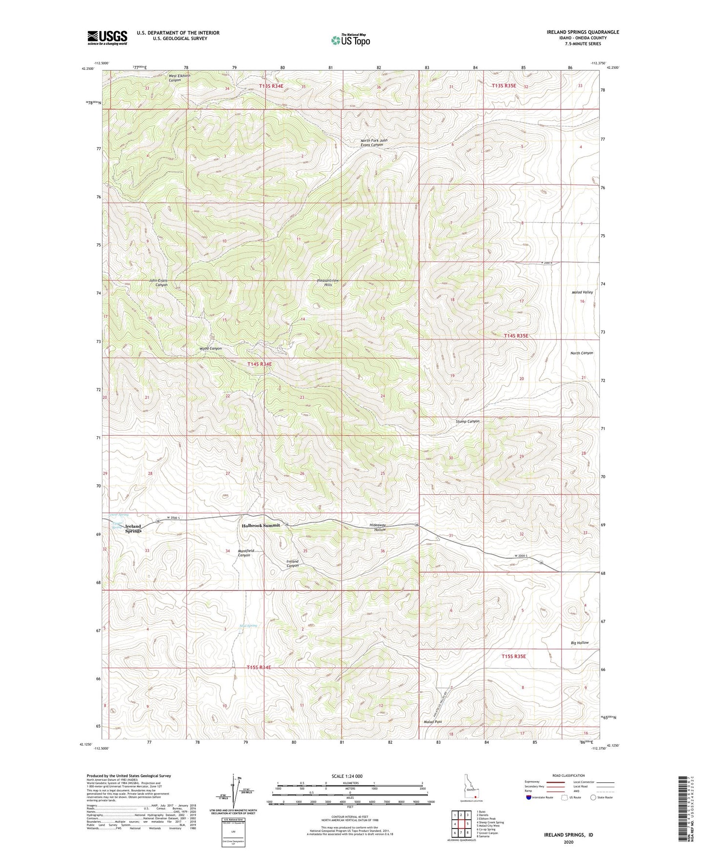
2023 topographic map quadrangle Ireland Springs in the state of Idaho. Scale: 1:24000. Based on the newly updated USGS 7.5' US Topo map series, this map is in the following counties: Oneida. The map contains contour data, water features, and other items you are used to seeing on USGS maps, but also has updated roads and other features. This is the next generation of topographic maps. Printed on high-quality waterproof paper with UV fade-resistant inks.
Quads adjacent to this one:
West: Sheep Creek Spring
Northwest: Buist
North: Daniels
Northeast: Elkhorn Peak
East: Malad City West
Southeast: Samaria
South: Grover Canyon
Southwest: Co-op Spring
This map covers the same area as the classic USGS quad with code o42112b4.
Contains the following named places: Big Hollow, Hideaway Hollow, Holbrook Summit, Ireland Springs, Lower Spring, Mansfield Canyon, Mud Spring, North Canyon, North Fork John Evans Canyon, Pleasantview Hills, Stump Canyon, Upper Spring, ZIP Code: 83252