MyTopo
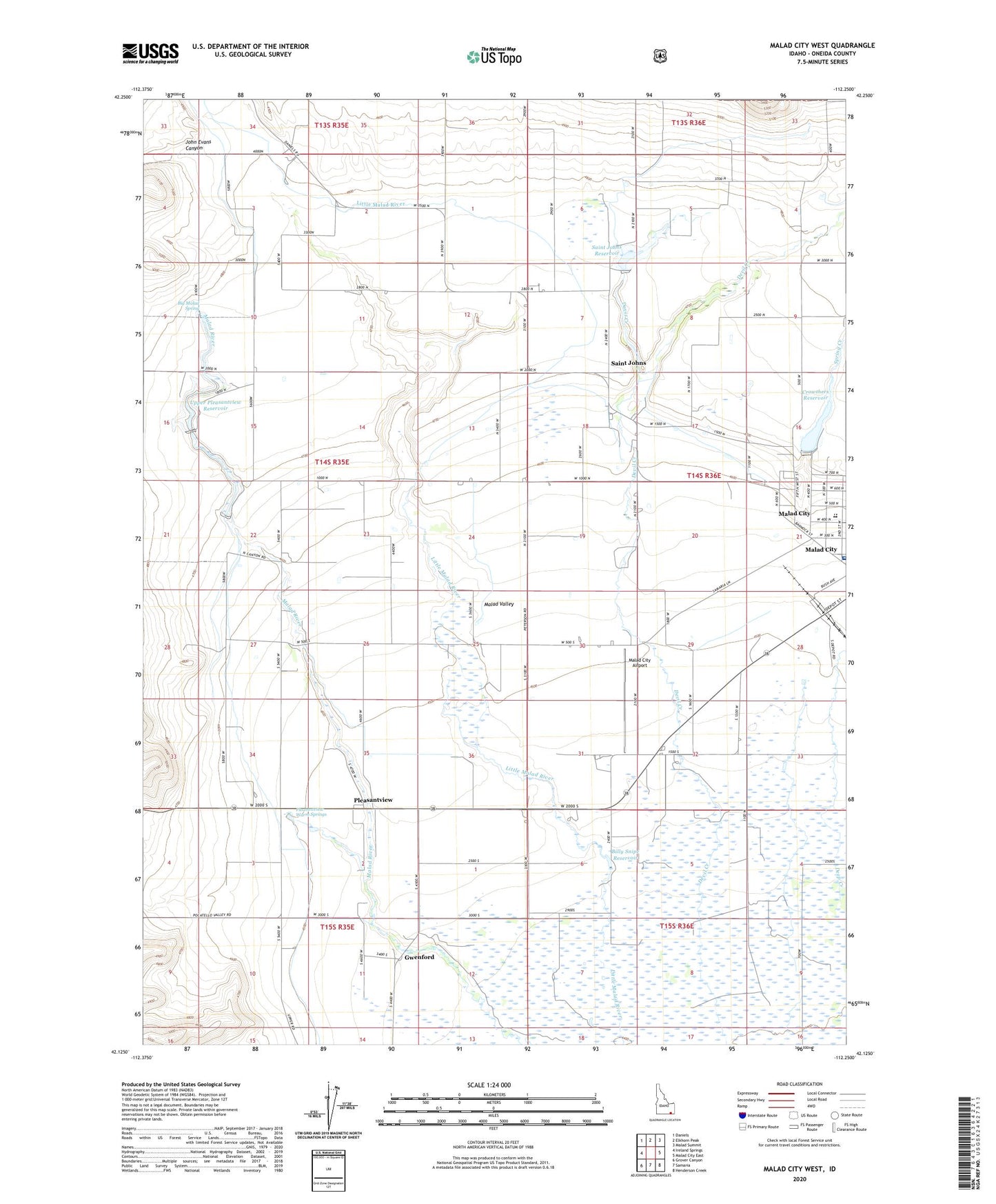
Malad City West Idaho US Topo Map
Couldn't load pickup availability
Also explore the Malad City West Forest Service Topo of this same quad for updated USFS data
2023 topographic map quadrangle Malad City West in the state of Idaho. Scale: 1:24000. Based on the newly updated USGS 7.5' US Topo map series, this map is in the following counties: Oneida. The map contains contour data, water features, and other items you are used to seeing on USGS maps, but also has updated roads and other features. This is the next generation of topographic maps. Printed on high-quality waterproof paper with UV fade-resistant inks.
Quads adjacent to this one:
West: Ireland Springs
Northwest: Daniels
North: Elkhorn Peak
Northeast: Malad Summit
East: Malad City East
Southeast: Henderson Creek
South: Samaria
Southwest: Grover Canyon
This map covers the same area as the classic USGS quad with code o42112b3.
Contains the following named places: Big Malad Spring, Billy Snipe Reservoir, Crowther Brothers Reservoir Public Fishing Area, Crowther Dam, Crowthers Reservoir, Davis Creek, Deep Creek, Gwenford, John Evans Canyon, Lower Pleasantview Reservoir, Malad City, Malad City Airport, Malad City Division, Malad Elementary School, Malad Precinct, Malad Substation, Nell J Redfield Memorial Hospital, Pleasantview, Pleasantview Warm Springs, Saint John Dam, Saint John Reservoir Public Fishing Area, Saint Johns, Saint Johns Reservoir, Samaria Number One Lower Dam, Samaria Number Two Upper Dam, Spring Creek, Upper Pleasantview Reservoir