MyTopo
Grover Canyon Idaho US Topo Map
Couldn't load pickup availability
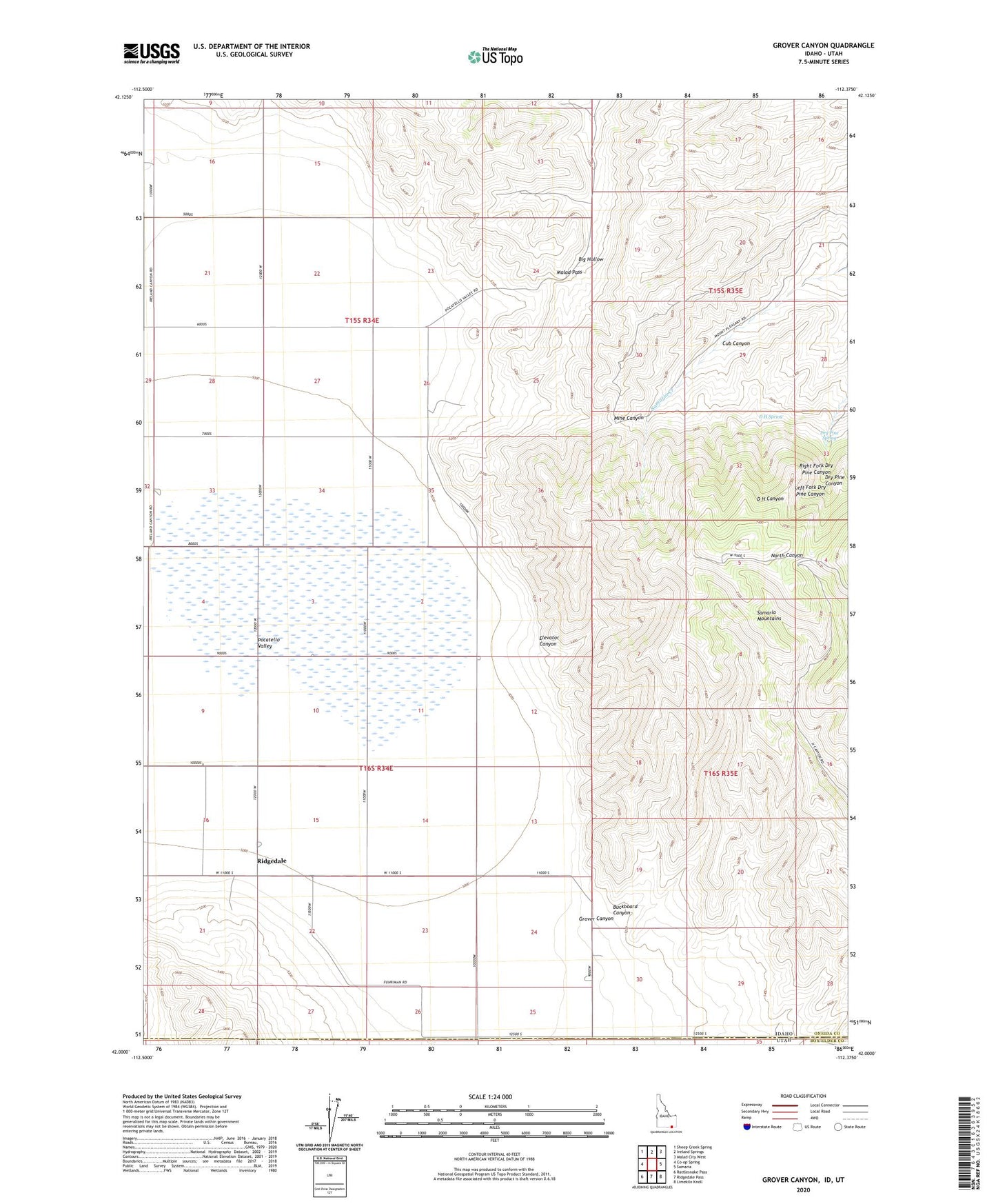
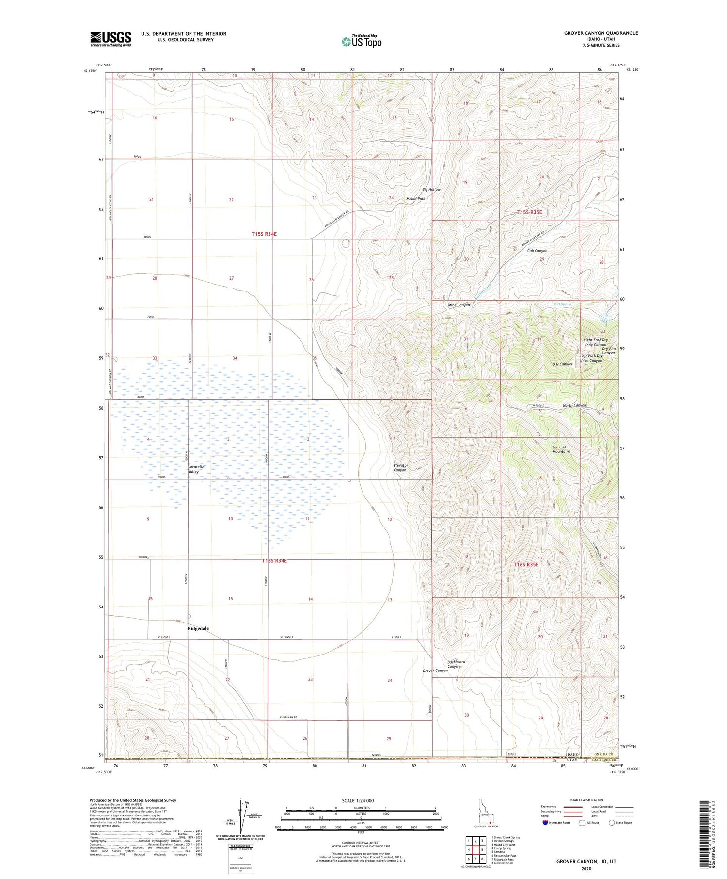
2023 topographic map quadrangle Grover Canyon in the state of Idaho. Scale: 1:24000. Based on the newly updated USGS 7.5' US Topo map series, this map is in the following counties: Oneida, Box Elder. The map contains contour data, water features, and other items you are used to seeing on USGS maps, but also has updated roads and other features. This is the next generation of topographic maps. Printed on high-quality waterproof paper with UV fade-resistant inks.
Quads adjacent to this one:
West: Co-op Spring
Northwest: Sheep Creek Spring
North: Ireland Springs
Northeast: Malad City West
East: Samaria
Southeast: Limekiln Knoll
South: Ridgedale Pass
Southwest: Rattlesnake Pass
Contains the following named places: Buckboard Canyon, Cub Canyon, D H Spring, Dry Pine Spring, Elevator Canyon, Grover Canyon, Left Fork Dry Pine Canyon, Malad Pass, Mine Canyon, Pocatello Valley, Ridgedale, Ridgedale Post Office, Right Fork Dry Pine Canyon