MyTopo
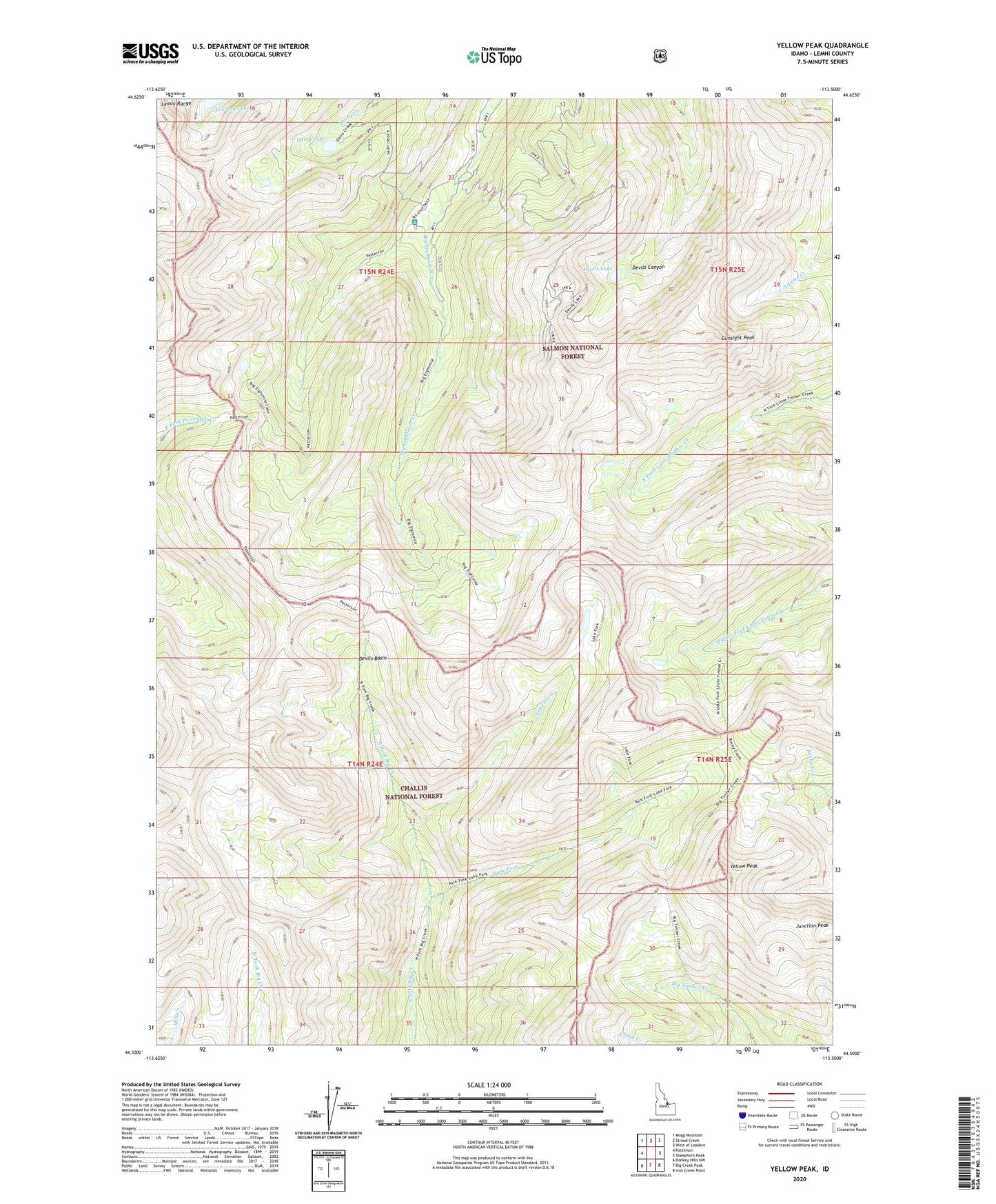
Yellow Peak Idaho US Topo Map
Couldn't load pickup availability
Also explore the Yellow Peak Forest Service Topo of this same quad for updated USFS data
2024 topographic map quadrangle Yellow Peak in the state of Idaho. Scale: 1:24000. Based on the newly updated USGS 7.5' US Topo map series, this map is in the following counties: Lemhi. The map contains contour data, water features, and other items you are used to seeing on USGS maps, but also has updated roads and other features. This is the next generation of topographic maps. Printed on high-quality waterproof paper with UV fade-resistant inks.
Quads adjacent to this one:
West: Patterson
Northwest: Mogg Mountain
North: Stroud Creek
Northeast: West of Leadore
East: Sheephorn Peak
Southeast: Iron Creek Point
South: Big Creek Peak
Southwest: Donkey Hills NW
This map covers the same area as the classic USGS quad with code o44113e5.
Contains the following named places: Big Eightmile Campground, Blue Jay Mine, Dairy Lake, Devils Basin, Devils Lake, Gunsight Peak, Junction Peak, Lake Fork, Lemhi Range, Park Fork, Ray Lode Mine, Yellow Peak