MyTopo
Kuna Idaho US Topo Map
Couldn't load pickup availability
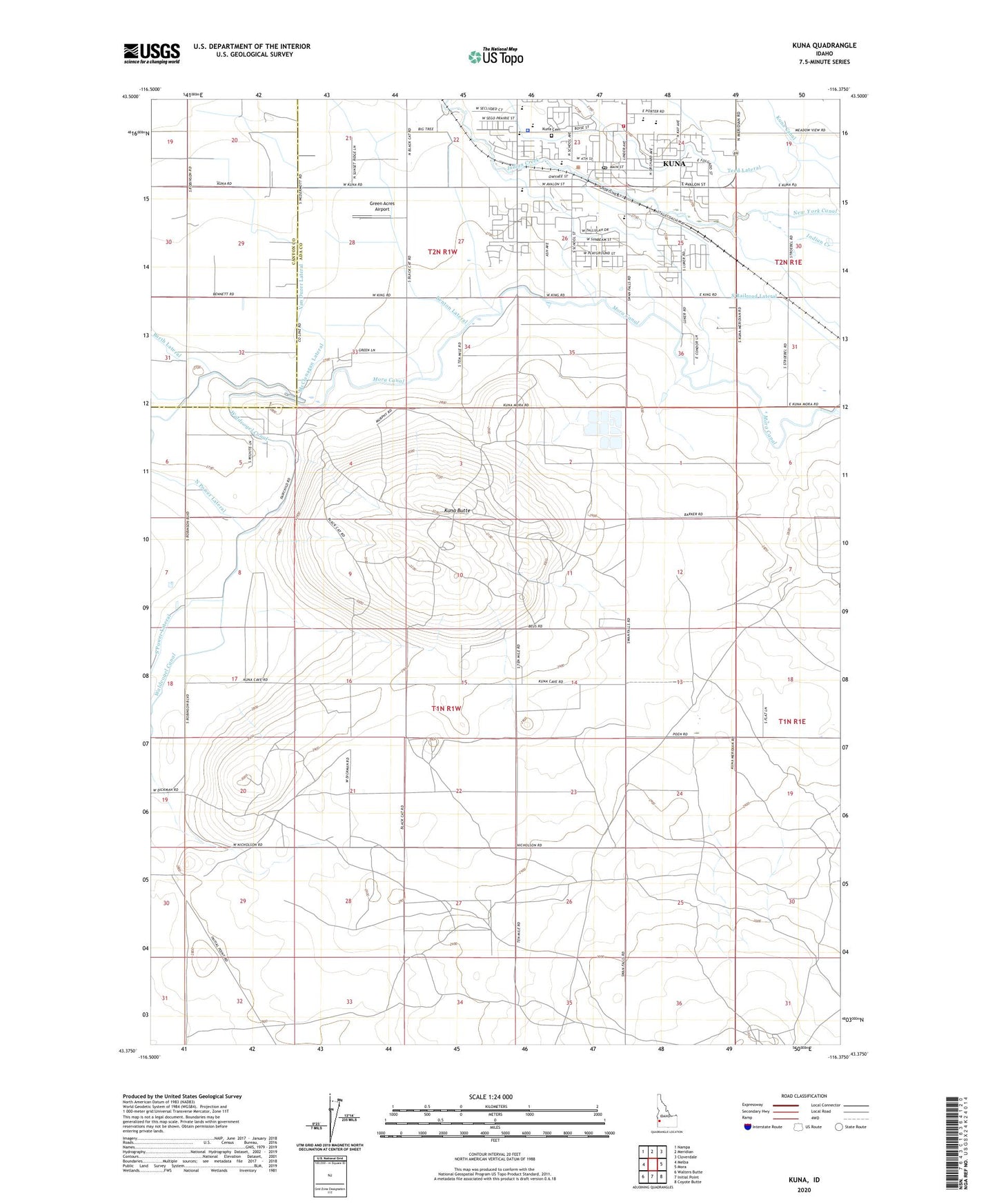
2024 topographic map quadrangle Kuna in the state of Idaho. Scale: 1:24000. Based on the newly updated USGS 7.5' US Topo map series, this map is in the following counties: Ada, Canyon. The map contains contour data, water features, and other items you are used to seeing on USGS maps, but also has updated roads and other features. This is the next generation of topographic maps. Printed on high-quality waterproof paper with UV fade-resistant inks.
Quads adjacent to this one:
West: Melba
Northwest: Nampa
North: Meridian
Northeast: Cloverdale
East: Mora
Southeast: Coyote Butte
South: Initial Point
Southwest: Walters Butte
This map covers the same area as the classic USGS quad with code o43116d4.
Contains the following named places: Benton Lateral, City of Kuna, East Fork Golden Gulch Drain, Green Acres Airport, Hobbs Lateral, Hogue Lateral, Hubbard Elementary School, Indian Creek Elementary School, Jacobs Lateral, King Lateral, Kuna, Kuna Butte, Kuna Cemetery, Kuna Middle School, Kuna Pioneer Cemetery, Kuna Police Department, Kuna Post Office, Kuna Rural Fire District Station 1, Leonard Lateral, McClenagan Lateral, Mora Canal, North Indian Creek, Ross Elementary School, South Railroad Lateral, Teed Lateral, Van Duzer Lateral