MyTopo
Melba Idaho US Topo Map
Couldn't load pickup availability
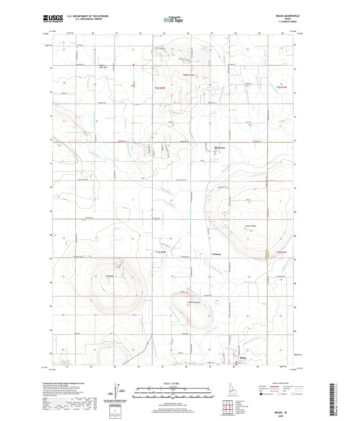
2023 topographic map quadrangle Melba in the state of Idaho. Scale: 1:24000. Based on the newly updated USGS 7.5' US Topo map series, this map is in the following counties: Canyon, Ada. The map contains contour data, water features, and other items you are used to seeing on USGS maps, but also has updated roads and other features. This is the next generation of topographic maps. Printed on high-quality waterproof paper with UV fade-resistant inks.
Quads adjacent to this one:
West: Givens Hot Springs
Northwest: Lake Lowell
North: Nampa
Northeast: Meridian
East: Kuna
Southeast: Initial Point
South: Walters Butte
Southwest: Wilson Peak
This map covers the same area as the classic USGS quad with code o43116d5.
Contains the following named places: Barth Lateral, Bennett Lateral, Bernard Wasteway, Bowmont, Butte Lateral, Coe Lateral, Coulee Drain, East Madden Lateral, East Railroad Lateral, Flume Lateral, Garland Drain, Happy Valley School, Hat Butte, Hat Butte Lateral, Madden Butte, Martin Lateral, McElroy Butte, Melba, Melba Division, Melba Drain, Melba Elementary School, Melba Fire Department, Melba Middle School, Melba Post Office, Melmont, Nampa Teen Parent Alternative, North McElroy Lateral, North Power Lateral, Pass Lateral, Powers Butte, Rivett Lateral, Rock Spur Drain, Sleepy Hollow Drain, South McElroy Lateral, South Power Lateral, Three Buttes Drain, Upper Deer Flat, Upper Deer Flat Fire Department, Waldvogel Canal, West Fork Golden Gulch Drain, West Madden Lateral, Westma, Willard Lateral, ZIP Code: 83686