MyTopo
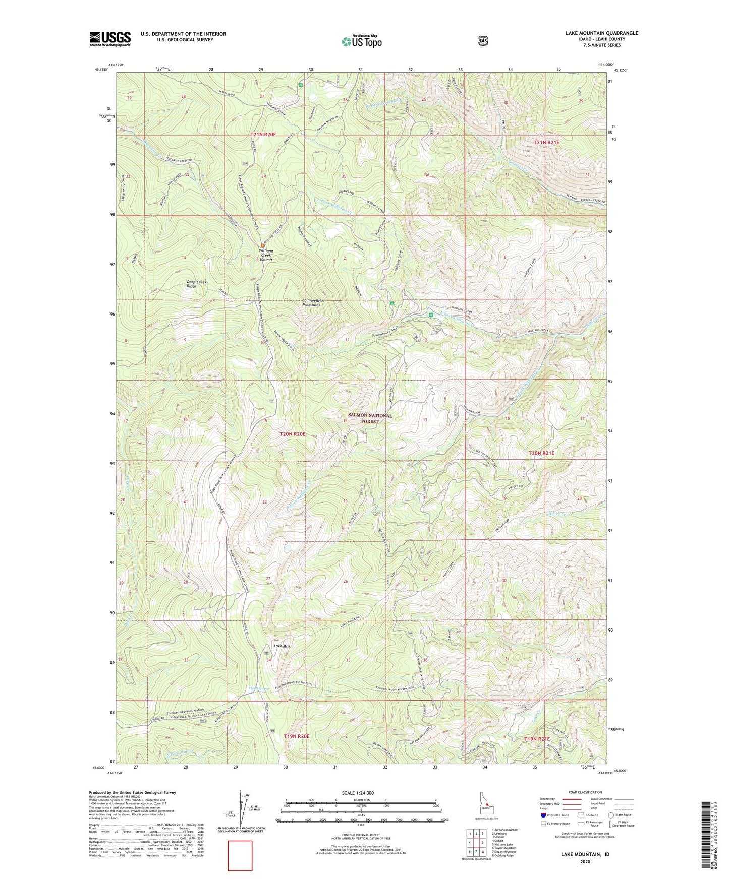
Lake Mountain Idaho US Topo Map
Couldn't load pickup availability
Also explore the Lake Mountain Forest Service Topo of this same quad for updated USFS data
2024 topographic map quadrangle Lake Mountain in the state of Idaho. Scale: 1:24000. Based on the newly updated USGS 7.5' US Topo map series, this map is in the following counties: Lemhi. The map contains contour data, water features, and other items you are used to seeing on USGS maps, but also has updated roads and other features. This is the next generation of topographic maps. Printed on high-quality waterproof paper with UV fade-resistant inks.
Quads adjacent to this one:
West: Cobalt
Northwest: Jureano Mountain
North: Leesburg
Northeast: Salmon
East: Williams Lake
Southeast: Goldbug Ridge
South: Degan Mountain
Southwest: Taylor Mountain
This map covers the same area as the classic USGS quad with code o45114a1.
Contains the following named places: China Spring, Cougar Point Recreation Site, Deep Creek Ridge, Lake Mountain, North Fork Williams Creek, Peterson Ranch, South Fork Williams Creek, West Fork Perreau Creek, Williams Creek Ranger Station, Williams Creek Summit