
MyTopo
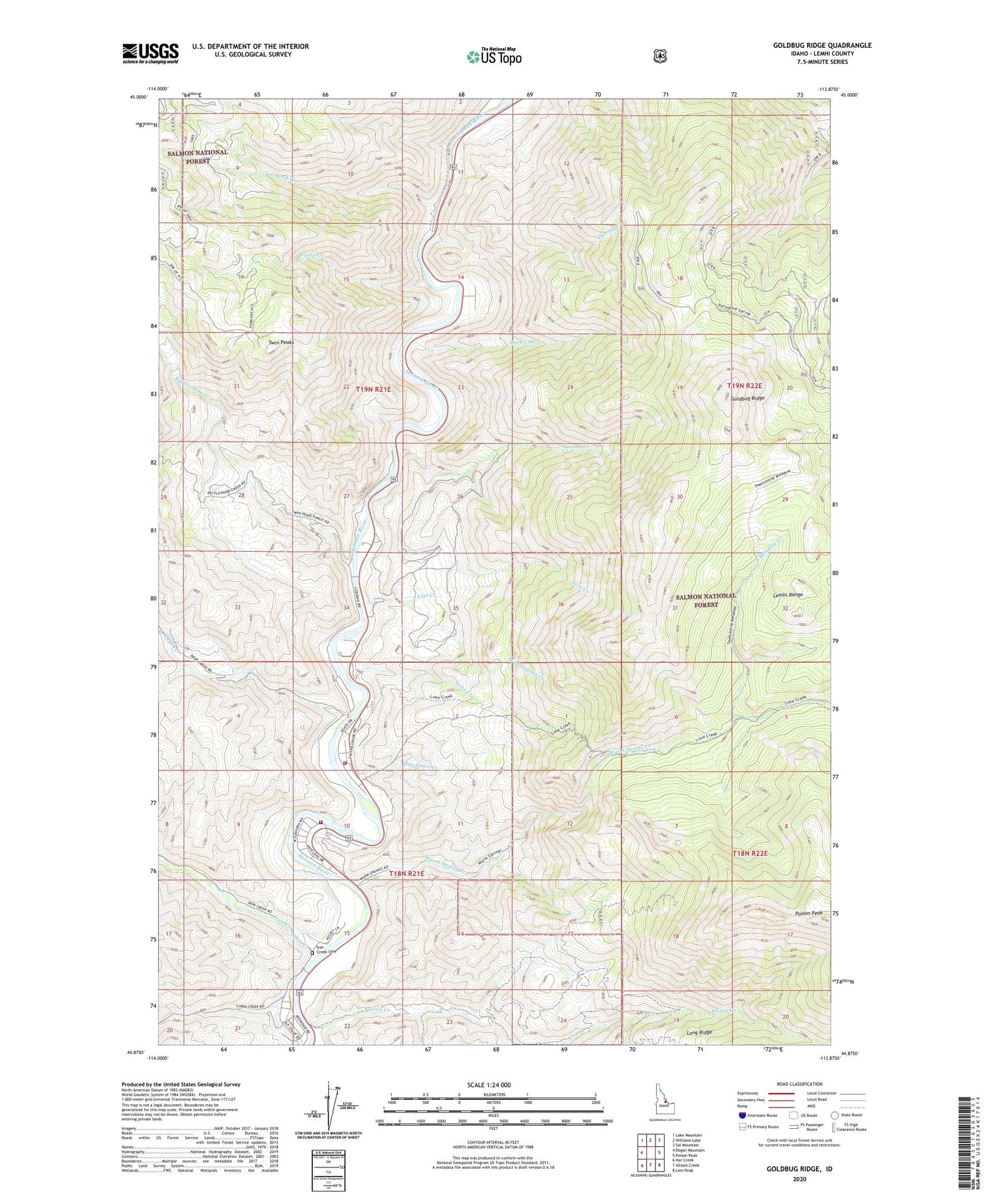
Goldbug Ridge Idaho US Topo Map
Couldn't load pickup availability
Also explore the Goldbug Ridge Forest Service Topo of this same quad for updated USFS data
2024 topographic map quadrangle Goldbug Ridge in the state of Idaho. Scale: 1:24000. Based on the newly updated USGS 7.5' US Topo map series, this map is in the following counties: Lemhi. The map contains contour data, water features, and other items you are used to seeing on USGS maps, but also has updated roads and other features. This is the next generation of topographic maps. Printed on high-quality waterproof paper with UV fade-resistant inks.
Quads adjacent to this one:
West: Degan Mountain
Northwest: Lake Mountain
North: Williams Lake
Northeast: Sal Mountain
East: Poison Peak
Southeast: Lem Peak
South: Allison Creek
Southwest: Hat Creek
This map covers the same area as the classic USGS quad with code o44113h8.
Contains the following named places: Birch Creek, Briney Creek, Buck Lake, Cabin Creek, Camp Creek, Camp Creek Access Area, Deer Creek, Dummy Creek, Elk Bend, Elk Bend Fire Protection District Station 1, Elk Bend Fire Protection District Station 2, Goldbug Ridge, Iron Creek, Iron Creek Cemetery, Lemhi County, Lime Creek, Lime Creek Access Area, Lost Creek, Meadow Creek, Phantom Creek, Poison Creek, Rattlesnake Creek, Rye Grass Creek, Second Creek, South Fork Poison Creek, Twin Peaks, Twin Peaks Ranch, Waddington Creek, Warm Spring Creek, ZIP Code: 83467


