MyTopo
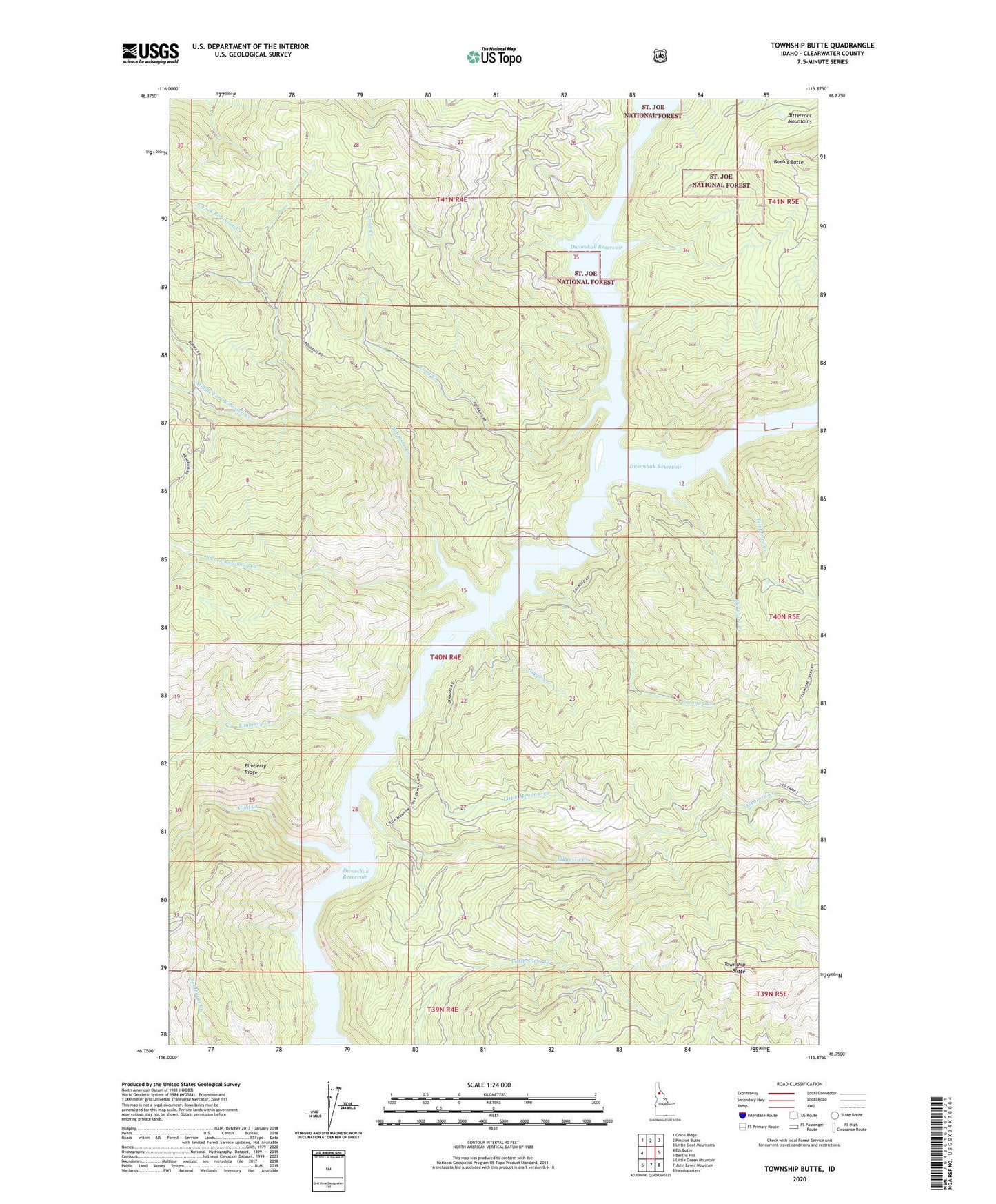
Township Butte Idaho US Topo Map
Couldn't load pickup availability
Also explore the Township Butte Forest Service Topo of this same quad for updated USFS data
2024 topographic map quadrangle Township Butte in the state of Idaho. Scale: 1:24000. Based on the newly updated USGS 7.5' US Topo map series, this map is in the following counties: Clearwater. The map contains contour data, water features, and other items you are used to seeing on USGS maps, but also has updated roads and other features. This is the next generation of topographic maps. Printed on high-quality waterproof paper with UV fade-resistant inks.
Quads adjacent to this one:
West: Elk Butte
Northwest: Grice Ridge
North: Pinchot Butte
Northeast: Little Goat Mountains
East: Bertha Hill
Southeast: Headquarters
South: John Lewis Mountain
Southwest: Little Green Mountain
This map covers the same area as the classic USGS quad with code o46115g8.
Contains the following named places: Armstrong Lookout, Boehls, Breakfast Creek, Elkberry Creek, Elmberry Creek, Gold Creek, Grandad Creek, Gyppo Creek, Little Meadow Creek, Little North Fork Clearwater River, Long Creek, McIntyre Creek, Middle Fork Robinson Creek, North Fork Robinson Creek, Robinson Creek, Rukgaber Trail, Silver Creek, South Fork Robinson Creek, Telephone Creek, Township Butte