MyTopo
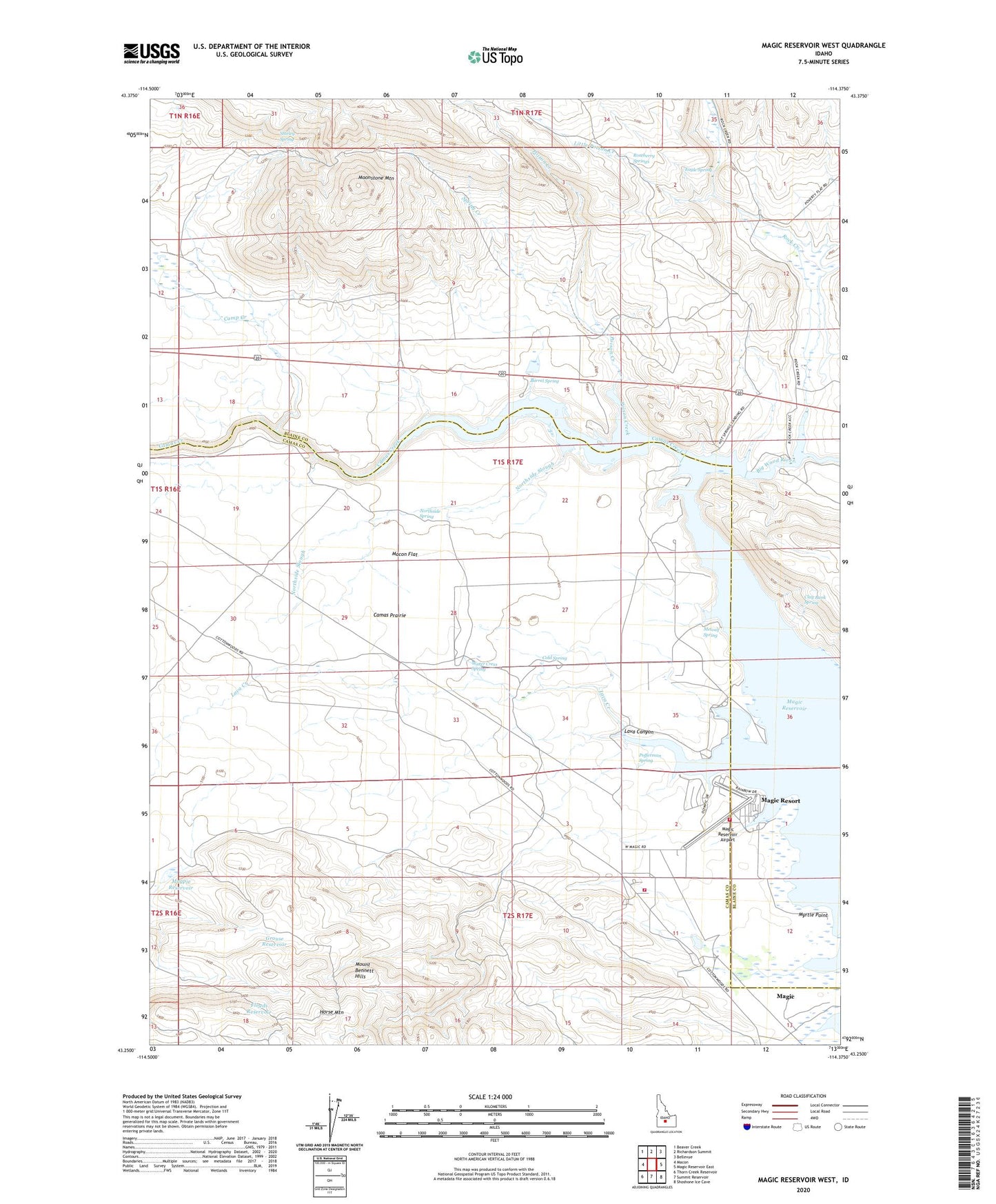
Magic Reservoir West Idaho US Topo Map
Couldn't load pickup availability
2024 topographic map quadrangle Magic Reservoir West in the state of Idaho. Scale: 1:24000. Based on the newly updated USGS 7.5' US Topo map series, this map is in the following counties: Camas, Blaine. The map contains contour data, water features, and other items you are used to seeing on USGS maps, but also has updated roads and other features. This is the next generation of topographic maps. Printed on high-quality waterproof paper with UV fade-resistant inks.
Quads adjacent to this one:
West: Macon
Northwest: Beaver Creek
North: Richardson Summit
Northeast: Bellevue
East: Magic Reservoir East
Southeast: Shoshone Ice Cave
South: Summit Reservoir
Southwest: Thorn Creek Reservoir
This map covers the same area as the classic USGS quad with code o43114c4.
Contains the following named places: Barrel Spring, Camas Creek, Camp Creek, Clay Bank Spring, Cold Spring, Eagle Spring, Floyds Reservoir, Grouse Reservoir, Horse Mountain, Hot Springs Landing, Lava Canyon, Lava Creek, Little Poison Creek, Little Rock Creek, Macon Flat, Magic, Magic Reservoir, Magic Reservoir Airport, Magic Resort, Magpie Reservoir, Metcalf Spring, Moonstone Access Area, Moonstone Landing, Moonstone Mountain, Myrtle Point, Northside Slough, Northside Spring, Pofferman Spring, Poison Creek, Rock Creek, Rock Creek Ranch, Roseberry Springs, Rowley Ranch, Shirley Spring, Spring Creek, Water Cress Spring, West Magic Fire District Station 1, West Magic Fire District Station 2, Wood River Deer Migration Corridor