
MyTopo
Beaver Creek Idaho US Topo Map
Couldn't load pickup availability
Also explore the Beaver Creek Forest Service Topo of this same quad for updated USFS data
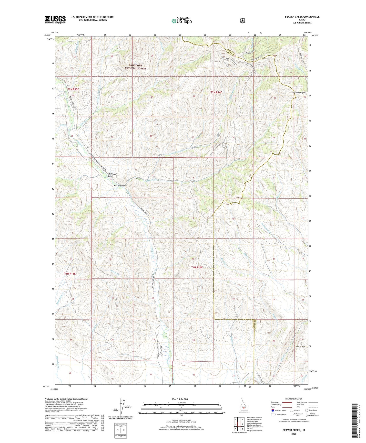
2023 topographic map quadrangle Beaver Creek in the state of Idaho. Scale: 1:24000. Based on the newly updated USGS 7.5' US Topo map series, this map is in the following counties: Camas, Blaine. The map contains contour data, water features, and other items you are used to seeing on USGS maps, but also has updated roads and other features. This is the next generation of topographic maps. Printed on high-quality waterproof paper with UV fade-resistant inks.
Quads adjacent to this one:
West: Cannonball Mountain
Northwest: Dollarhide Mountain
North: Buttercup Mountain
Northeast: Mahoney Butte
East: Richardson Summit
Southeast: Magic Reservoir West
South: Macon
Southwest: Spring Creek Reservoir
This map covers the same area as the classic USGS quad with code o43114d5.
Contains the following named places: Beaver Creek, Brush Creek, Chalmplain Creek, Cherry Creek, Happy Day Mine, Little Beaver Creek, Log Creek, McDonald Gulch, McKay Gulch, Nebraska Creek, North Fork Cherry Creek, Princess Blue Ribbon Mine, Severe Creek, Square Mountain, Wine Creek


