MyTopo
Summit Reservoir Idaho US Topo Map
Couldn't load pickup availability
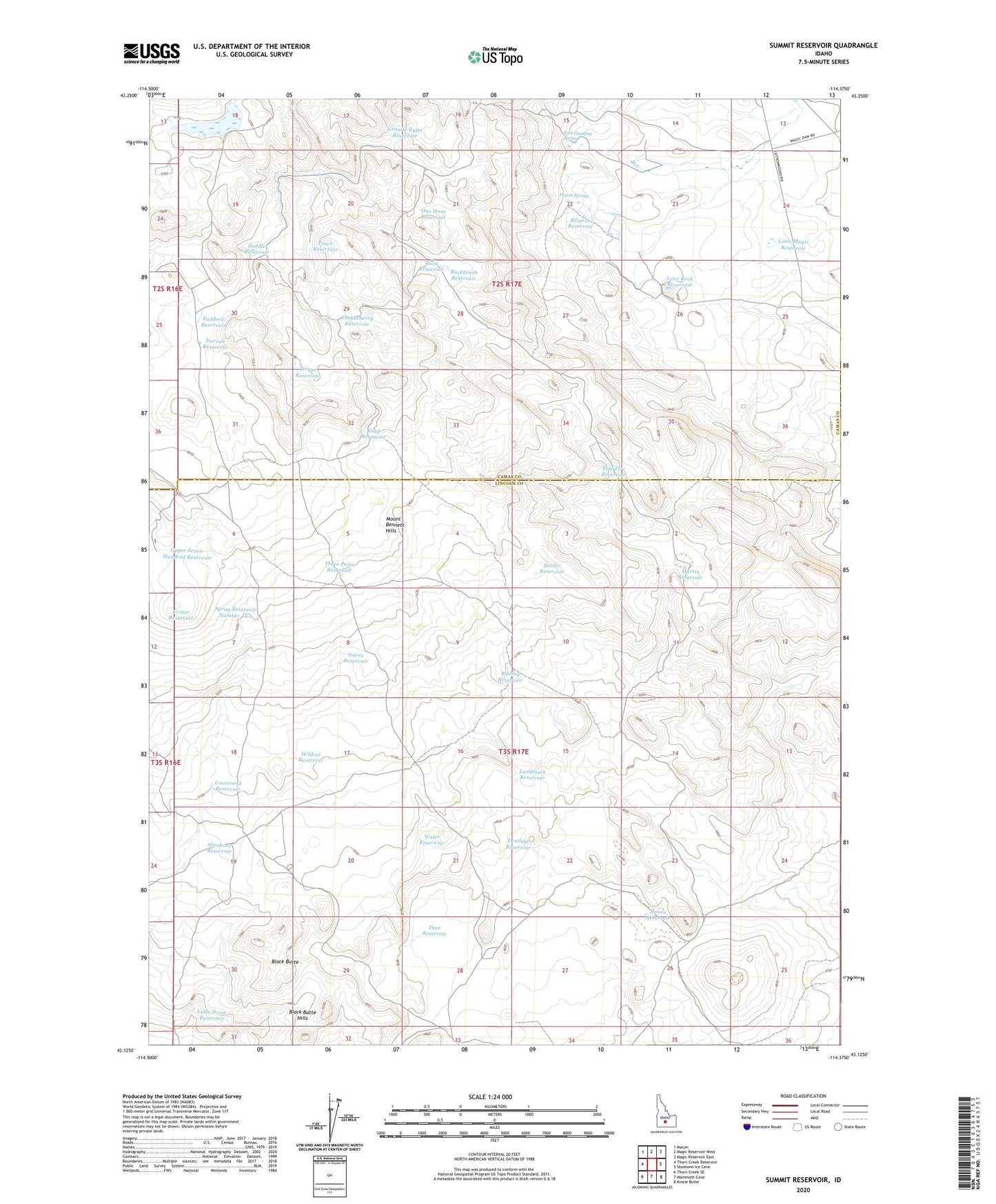
2024 topographic map quadrangle Summit Reservoir in the state of Idaho. Scale: 1:24000. Based on the newly updated USGS 7.5' US Topo map series, this map is in the following counties: Lincoln, Camas. The map contains contour data, water features, and other items you are used to seeing on USGS maps, but also has updated roads and other features. This is the next generation of topographic maps. Printed on high-quality waterproof paper with UV fade-resistant inks.
Quads adjacent to this one:
West: Thorn Creek Reservoir
Northwest: Macon
North: Magic Reservoir West
Northeast: Magic Reservoir East
East: Shoshone Ice Cave
Southeast: Kinzie Butte
South: Mammoth Cave
Southwest: Thorn Creek SE
This map covers the same area as the classic USGS quad with code o43114b4.
Contains the following named places: Association Well, Bailing Reservoir, Black Butte, Border Reservoir, Brailsford Well, Buckbrush Reservoir, Chokecherry Reservoir, Cirque Reservoir, Crater Reservoir, Crossroad Reservoir, Darrah Reservoir, Daves Reservoir, Deadeye Reservoir, Deer Reservoir, Dry Wash Dam, Fawn Reservoir, Flat Tire Reservoir, Granite Butte Reservoir, Jones Reservoir, Landmark Reservoir, Little Draw Reservoir, Little Magic Reservoir, Lone Rock Reservoir, Marsh Spring, Martin Reservoir, One Hour Reservoir, Paddock Reservoir, Reserve Reservoir, Road Reservoir, Saddle Reservoir, Shoshone Reservoir, Spray Reservoir Number Two, Summit Reservoir, Three Point Reservoir, Tom Gooding Spring, Twin Reservoir, Upper Seven-Hundred Reservoir, Water Reservoir, Wildcat Reservoir