MyTopo
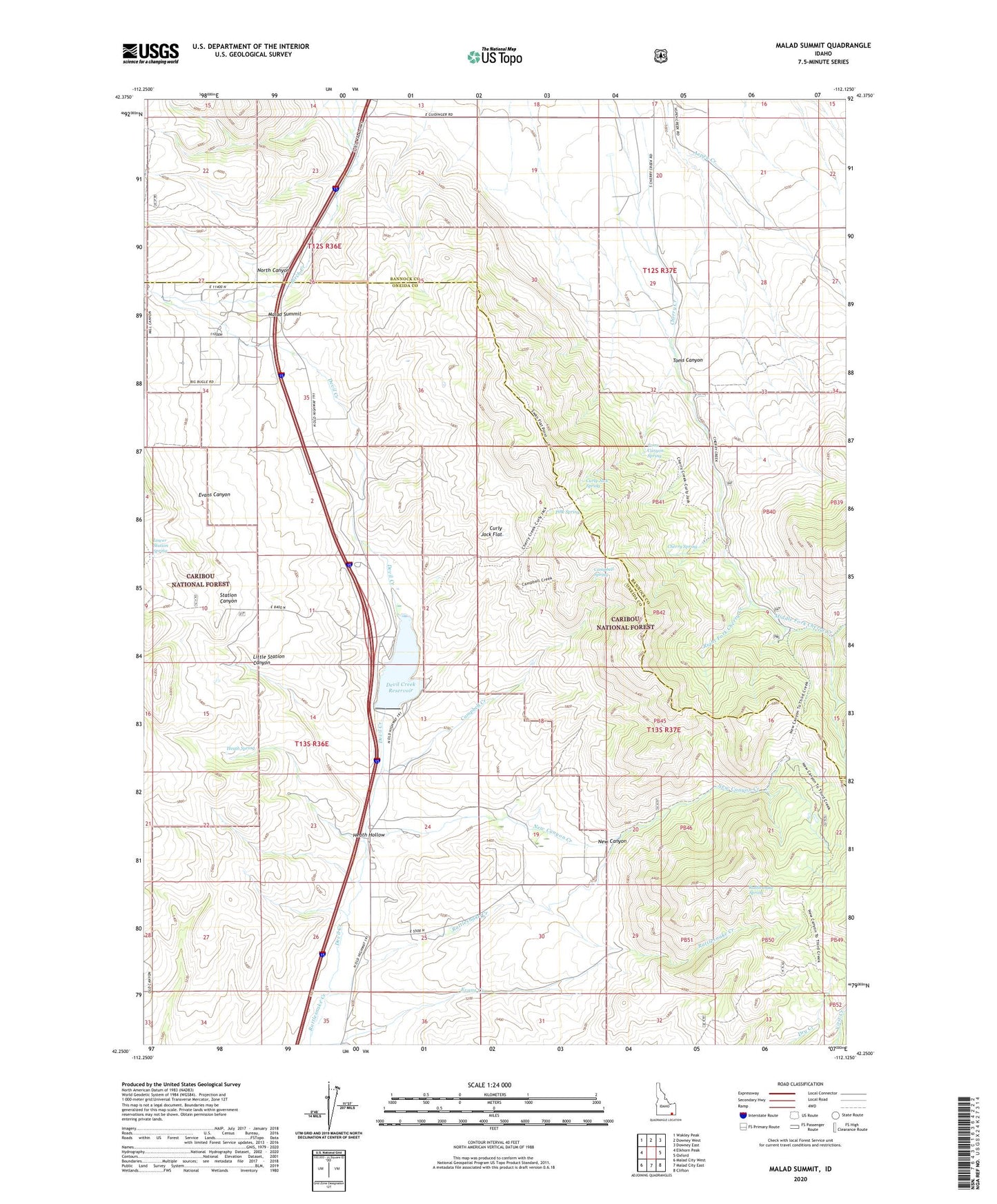
Malad Summit Idaho US Topo Map
Couldn't load pickup availability
Also explore the Malad Summit Forest Service Topo of this same quad for updated USFS data
2024 topographic map quadrangle Malad Summit in the state of Idaho. Scale: 1:24000. Based on the newly updated USGS 7.5' US Topo map series, this map is in the following counties: Oneida, Bannock, Franklin. The map contains contour data, water features, and other items you are used to seeing on USGS maps, but also has updated roads and other features. This is the next generation of topographic maps. Printed on high-quality waterproof paper with UV fade-resistant inks.
Quads adjacent to this one:
West: Elkhorn Peak
Northwest: Wakley Peak
North: Downey West
Northeast: Downey East
East: Oxford
Southeast: Clifton
South: Malad City East
Southwest: Malad City West
This map covers the same area as the classic USGS quad with code o42112c2.
Contains the following named places: Campbell Creek, Campbell Spring, Cherry Creek Campground, Cherry Spring, Curly Jack Flat, Curly Jack Spring, Devil Creek Dam, Devil Creek Reservoir, Devil Creek Reservoir Public Fishing Area, Evans Canyon, Heath Hollow, Heath Spring, Left Fork Cherry Creek, Little Station Canyon, Lower Station Spring, Malad Summit, Middle Fork Cherry Creek, Mill Creek, Mine Creek, New Canyon, New Canyon Creek, North Canyon, Pine Spring, Rattlesnake Creek, Rattlesnake Spring, Right Fork Cherry Creek, Station Canyon, Toms Canyon, Toms Canyon Spring