MyTopo
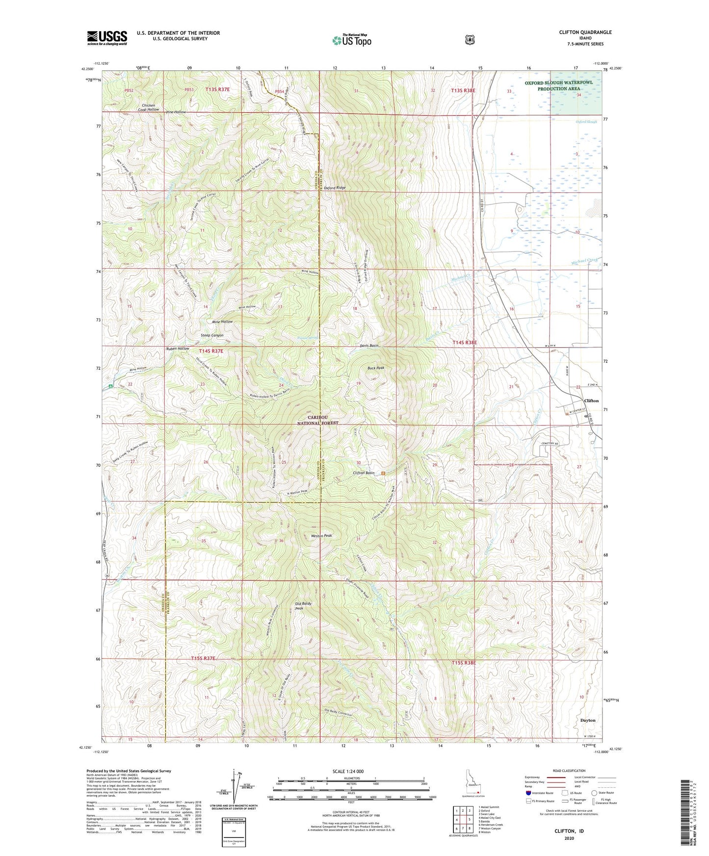
Clifton Idaho US Topo Map
Couldn't load pickup availability
Also explore the Clifton Forest Service Topo of this same quad for updated USFS data
2024 topographic map quadrangle Clifton in the state of Idaho. Scale: 1:24000. Based on the newly updated USGS 7.5' US Topo map series, this map is in the following counties: Franklin, Oneida. The map contains contour data, water features, and other items you are used to seeing on USGS maps, but also has updated roads and other features. This is the next generation of topographic maps. Printed on high-quality waterproof paper with UV fade-resistant inks.
Quads adjacent to this one:
West: Malad City East
Northwest: Malad Summit
North: Oxford
Northeast: Swan Lake
East: Banida
Southeast: Weston
South: Weston Canyon
Southwest: Henderson Creek
This map covers the same area as the classic USGS quad with code o42112b1.
Contains the following named places: Buck Peak, City of Clifton, Clifton, Clifton Basin, Clifton Cemetery, Clifton Creek, Clifton Post Office, Davis Basin, Davis Creek, Dayton Division, Michael Creek, Mine Hollow, North Fork Third Creek, Old Baldy Peak, Oxford Ridge, Poison Spring, Ruben Hollow, Steep Canyon, Third Creek, Weston Peak, ZIP Code: 83228