MyTopo
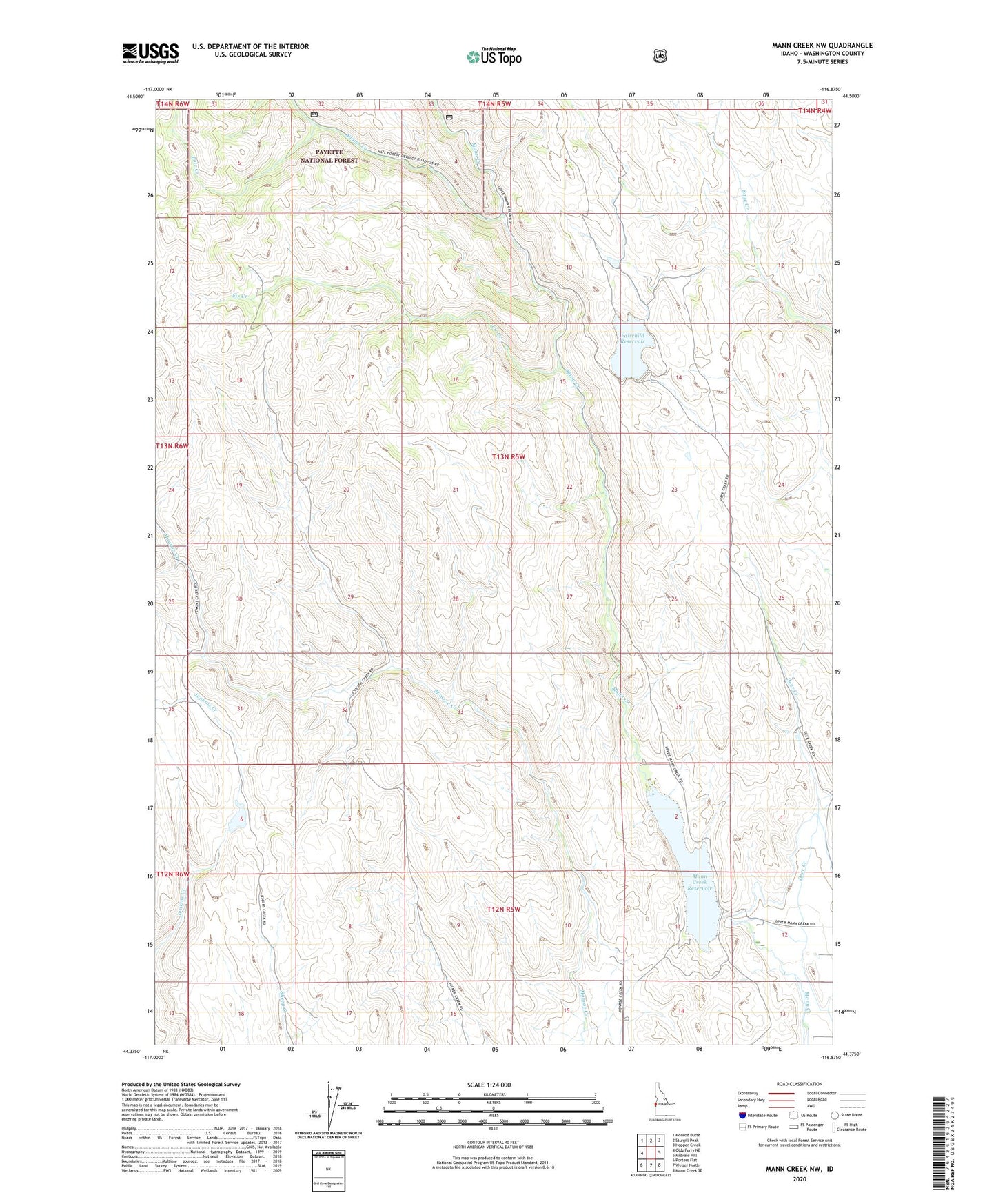
Mann Creek NW Idaho US Topo Map
Couldn't load pickup availability
Also explore the Mann Creek NW Forest Service Topo of this same quad for updated USFS data
2024 topographic map quadrangle Mann Creek NW in the state of Idaho. Scale: 1:24000. Based on the newly updated USGS 7.5' US Topo map series, this map is in the following counties: Washington. The map contains contour data, water features, and other items you are used to seeing on USGS maps, but also has updated roads and other features. This is the next generation of topographic maps. Printed on high-quality waterproof paper with UV fade-resistant inks.
Quads adjacent to this one:
West: Olds Ferry NE
Northwest: Monroe Butte
North: Sturgill Peak
Northeast: Hopper Creek
East: Midvale Hill
Southeast: Mann Creek SE
South: Weiser North
Southwest: Porters Flat
This map covers the same area as the classic USGS quad with code o44116d8.
Contains the following named places: Adams Creek, Deer Creek, Deer Creek School, Fairchild Dam, Fairchild Reservoir, Fir Creek, Mann Creek Dam, Mann Creek Reservoir, Mann Creek State Park, Monroe Dam, Pole Creek