MyTopo
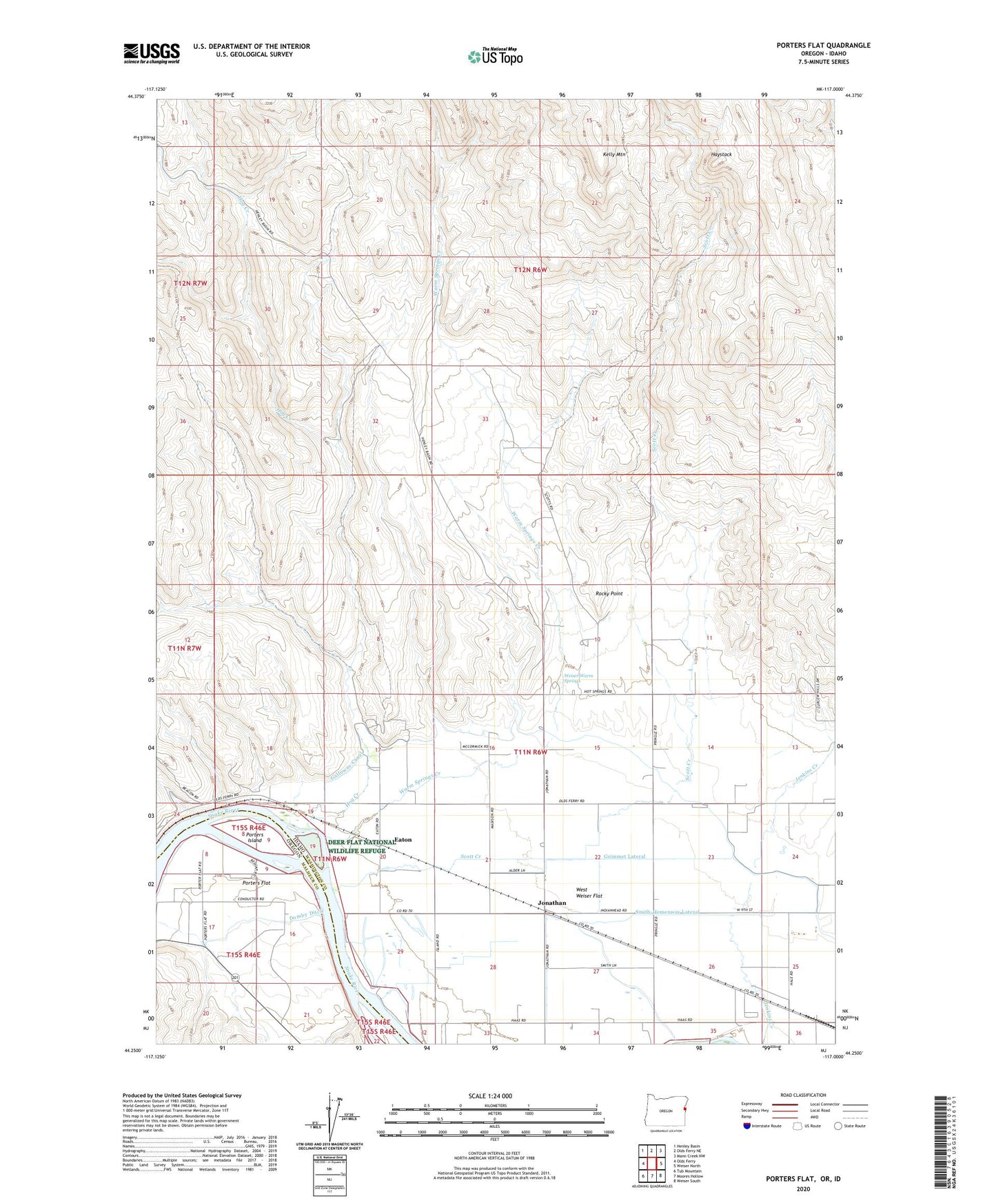
Porters Flat Oregon US Topo Map
Couldn't load pickup availability
2023 topographic map quadrangle Porters Flat in the states of Idaho, Oregon. Scale: 1:24000. Based on the newly updated USGS 7.5' US Topo map series, this map is in the following counties: Malheur, Washington. The map contains contour data, water features, and other items you are used to seeing on USGS maps, but also has updated roads and other features. This is the next generation of topographic maps. Printed on high-quality waterproof paper with UV fade-resistant inks.
Quads adjacent to this one:
West: Olds Ferry
Northwest: Henley Basin
North: Olds Ferry NE
Northeast: Mann Creek NW
East: Weiser North
Southeast: Weiser South
South: Moores Hollow
Southwest: Tub Mountain
This map covers the same area as the classic USGS quad with code o44117c1.
Contains the following named places: Central School, Domby Ditch, Eaton, Eaton School, Grimmet Lateral, Haas School, Hale School, Haystack, Hog Creek, Jonathan, Kelly Mountain, Porters Ferry, Porters Flat, Porters Island, Rocky Point, Scott Creek, Scott Creek Dam, Smith-Hemenway Lateral, Snake River Slides Safety Rest Area, Warm Springs Creek, Weiser Warm Springs, West Weiser Flat