MyTopo
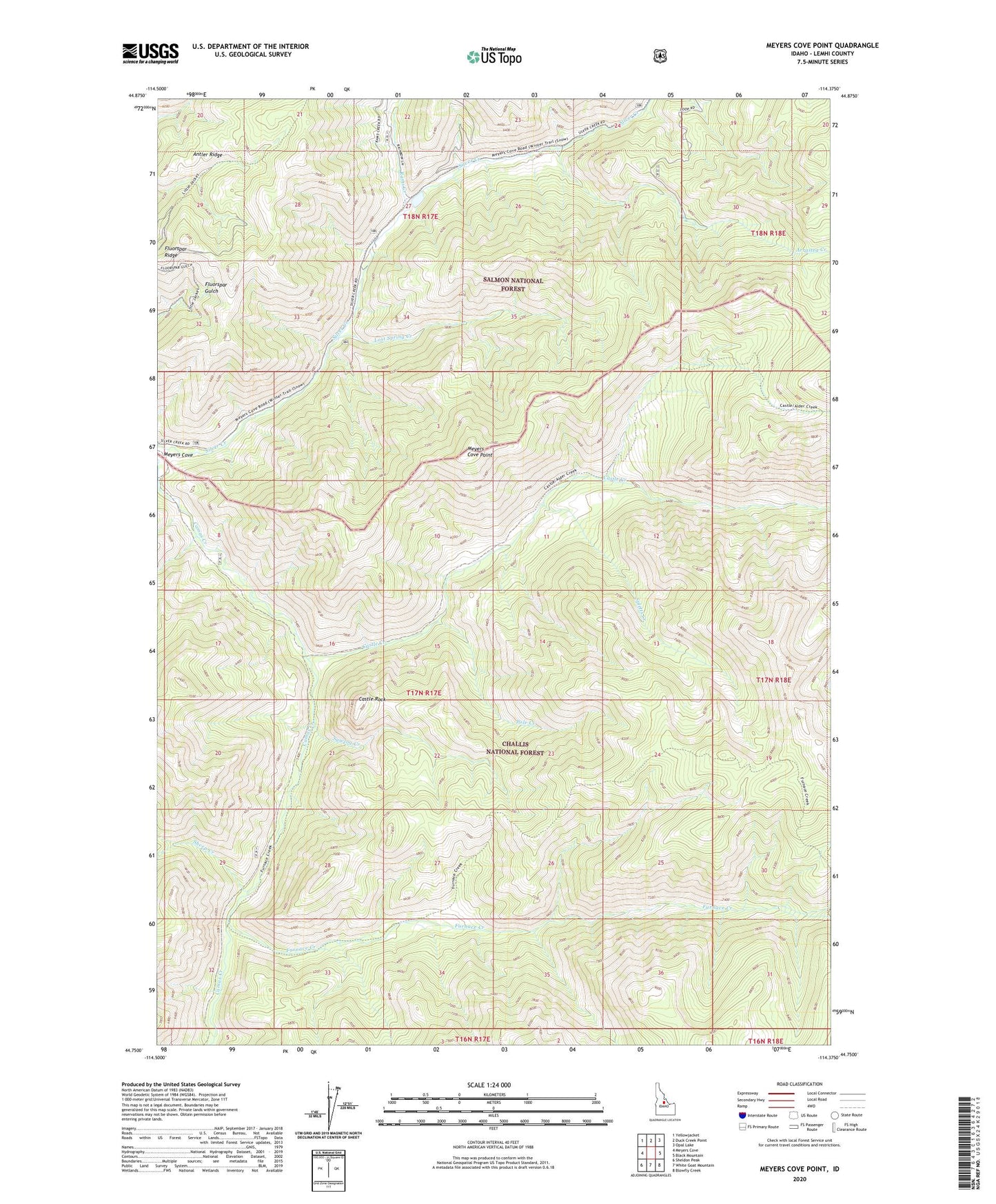
Meyers Cove Point Idaho US Topo Map
Couldn't load pickup availability
Also explore the Meyers Cove Point Forest Service Topo of this same quad for updated USFS data
2024 topographic map quadrangle Meyers Cove Point in the state of Idaho. Scale: 1:24000. Based on the newly updated USGS 7.5' US Topo map series, this map is in the following counties: Lemhi, Custer. The map contains contour data, water features, and other items you are used to seeing on USGS maps, but also has updated roads and other features. This is the next generation of topographic maps. Printed on high-quality waterproof paper with UV fade-resistant inks.
Quads adjacent to this one:
West: Meyers Cove
Northwest: Yellowjacket
North: Duck Creek Point
Northeast: Opal Lake
East: Black Mountain
Southeast: Blowfly Creek
South: White Goat Mountain
Southwest: Sheldon Peak
This map covers the same area as the classic USGS quad with code o44114g4.
Contains the following named places: Antler Ridge, Arrastra Creek, Boggeman Dam, Castle Creek, Castle Rock, Fluorspar Ridge, Furnace Creek, Lost Spring Campground, Lost Spring Creek, Meyers Cove Point, Pole Creek, Rams Creek, Sawlog Creek, Sheep Creek, Singheiser Mine, Spletts Creek, Splettstosser Ranch