MyTopo
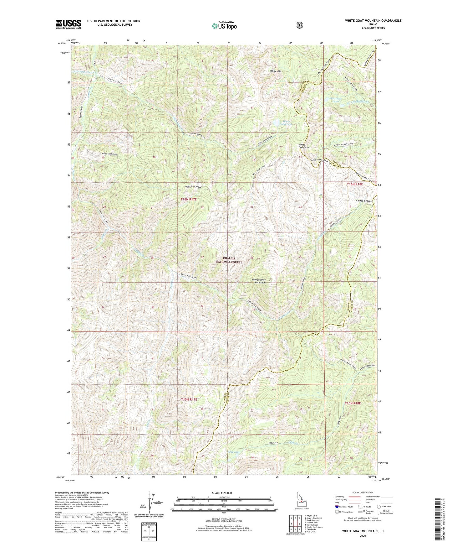
White Goat Mountain Idaho US Topo Map
Couldn't load pickup availability
Also explore the White Goat Mountain Forest Service Topo of this same quad for updated USFS data
2024 topographic map quadrangle White Goat Mountain in the state of Idaho. Scale: 1:24000. Based on the newly updated USGS 7.5' US Topo map series, this map is in the following counties: Lemhi, Custer. The map contains contour data, water features, and other items you are used to seeing on USGS maps, but also has updated roads and other features. This is the next generation of topographic maps. Printed on high-quality waterproof paper with UV fade-resistant inks.
Quads adjacent to this one:
West: Sheldon Peak
Northwest: Meyers Cove
North: Meyers Cove Point
Northeast: Black Mountain
East: Blowfly Creek
Southeast: Pats Creek
South: Twin Peaks
Southwest: Challis Creek Lakes
This map covers the same area as the classic USGS quad with code o44114f4.
Contains the following named places: Camas Meadows, Eddy Lake, Fly Creek, J Fell Creek, Little White Goat Creek, South Fork Camas Creek, Spider Creek, West Fork Lakes, White Goat Creek, White Goat Lake, White Goat Lookout, White Goat Mountain, White Mountain