MyTopo
Post Falls Idaho US Topo Map
Couldn't load pickup availability
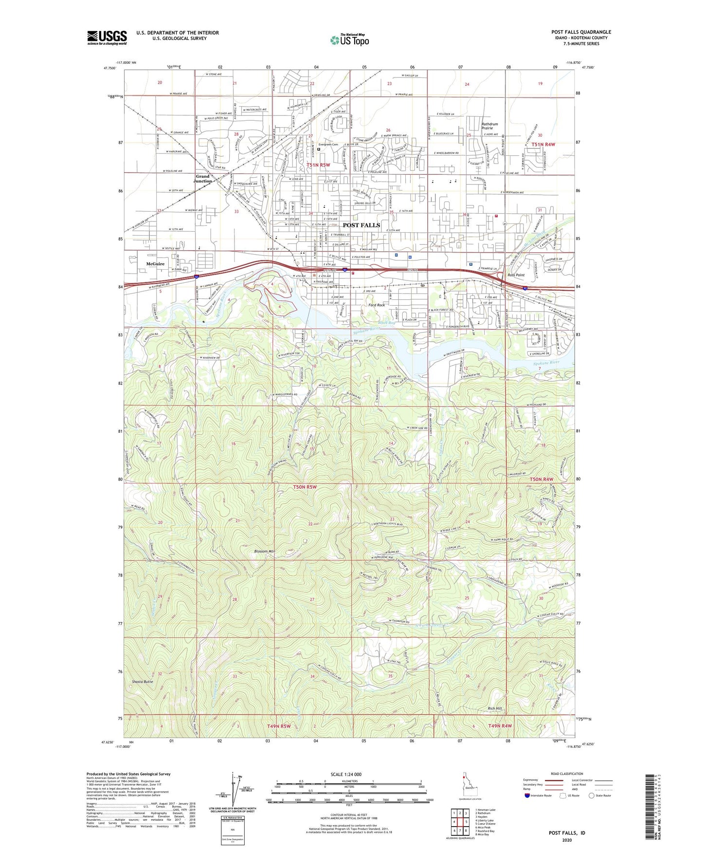
2024 topographic map quadrangle Post Falls in the state of Idaho. Scale: 1:24000. Based on the newly updated USGS 7.5' US Topo map series, this map is in the following counties: Kootenai. The map contains contour data, water features, and other items you are used to seeing on USGS maps, but also has updated roads and other features. This is the next generation of topographic maps. Printed on high-quality waterproof paper with UV fade-resistant inks.
Quads adjacent to this one:
West: Liberty Lake
Northwest: Newman Lake
North: Rathdrum
Northeast: Hayden
Southeast: Mica Bay
South: Rockford Bay
Southwest: Mica Peak
This map covers the same area as the classic USGS quad with code o47116f8.
Contains the following named places: Berean Church, Black Bay, Blossom Mountain, Cedar Creek, City of Post Falls, Cloverleaf Grange, Corbin Park, East Greenacres East Ditch, East Greenacres School, Evergreen Cemetery, Falls Christian Academy, Ford Rock, Frederick Post Kinder Center, Grand Junction, Hubofs Heliport, Hy Line Ditch, Immaculate Conception Academy, KCDA-FM (Coeur D'Alene), KETB-FM (Coeur D'Alene), Kootenai County Fire and Rescue Station 1, Kootenai County Fire and Rescue Station 3, Lenz Creek, McGuire, McGuire School, McGuires, McGuire-Wesleyan Church, Mullan Trail Elementary School, North Fork Cougar Creek, North Park, Northern Idaho Advanced Care Hospital, Northwest Specialty Hospital, Otterson Ranch Airport, Ponderosa Elementary School, Post Falls, Post Falls City Police, Post Falls Dam, Post Falls High School, Post Falls Post Office, Post Falls Square Shopping Center, Rich Hill, River Park, Ross Point, Ross Point Bird Farm, Schetkwe', Seltice Elementary School, Shasta Butte, ZIP Code: 83854