MyTopo
Michaud Idaho US Topo Map
Couldn't load pickup availability
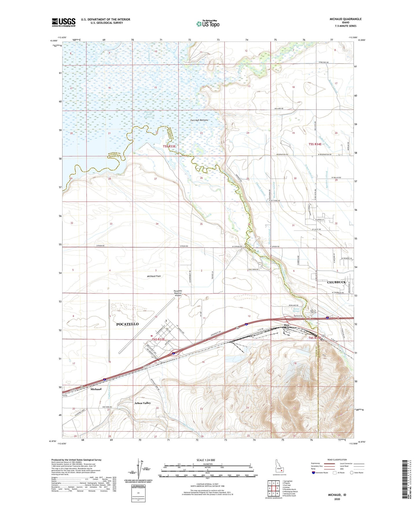
2024 topographic map quadrangle Michaud in the state of Idaho. Scale: 1:24000. Based on the newly updated USGS 7.5' US Topo map series, this map is in the following counties: Power, Bannock. The map contains contour data, water features, and other items you are used to seeing on USGS maps, but also has updated roads and other features. This is the next generation of topographic maps. Printed on high-quality waterproof paper with UV fade-resistant inks.
Quads adjacent to this one:
West: Schiller
Northwest: Springfield
North: Pingree
Northeast: Fort Hall
East: Pocatello North
Southeast: Pocatello South
South: Michaud Creek
Southwest: Wheatgrass Bench
This map covers the same area as the classic USGS quad with code o42112h5.
Contains the following named places: Arbon Valley Census Designated Place, Batiste Springs, Church Lateral, Clear Creek, Don, Havenor Lateral, Havenor Siphon, Hayes Lateral, Hooker Lateral, Indian Cemetery, Kinney Creek, KRCD-AM (Chubbuck), Martin Lateral, Michaud, Michaud Creek, Michaud Flats, Pocatello Army Air Field, Pocatello Fire Department Station 4, Pocatello Regional Airport, Ross Fork, Spraker Lateral, Taghee Canal, Tyhee Lateral