MyTopo
Fort Hall Idaho US Topo Map
Couldn't load pickup availability
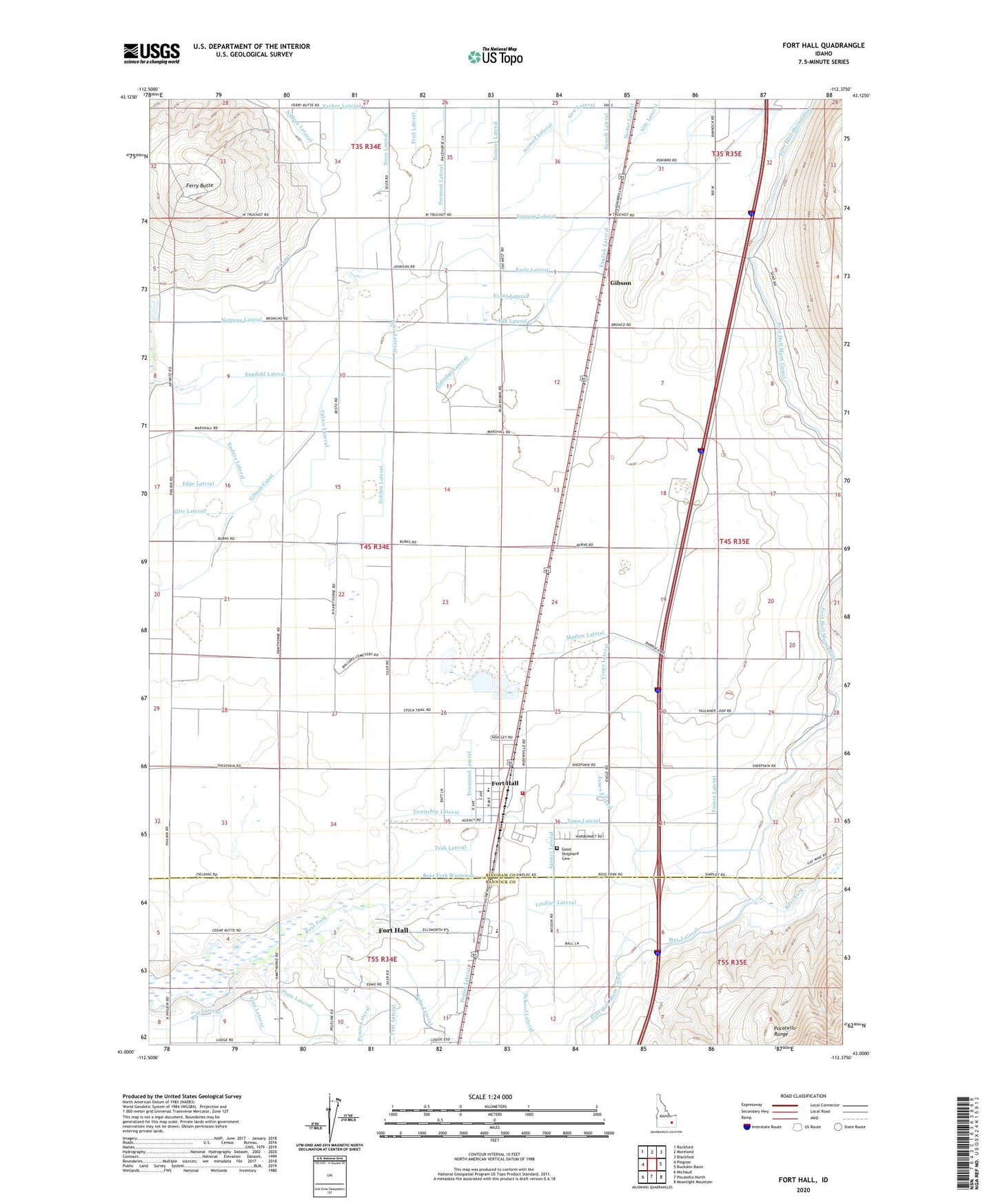
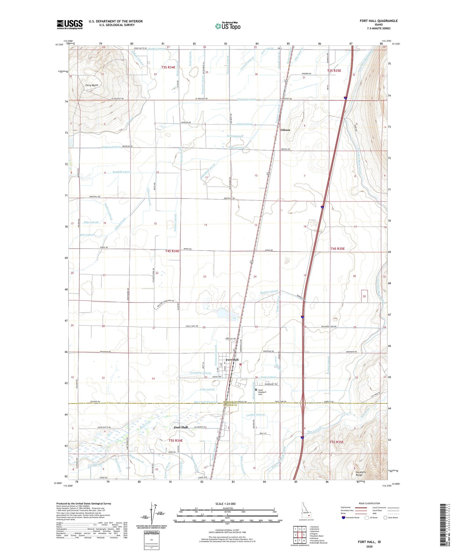
2024 topographic map quadrangle Fort Hall in the state of Idaho. Scale: 1:24000. Based on the newly updated USGS 7.5' US Topo map series, this map is in the following counties: Bingham, Bannock. The map contains contour data, water features, and other items you are used to seeing on USGS maps, but also has updated roads and other features. This is the next generation of topographic maps. Printed on high-quality waterproof paper with UV fade-resistant inks.
Quads adjacent to this one:
West: Pingree
Northwest: Rockford
North: Moreland
Northeast: Blackfoot
East: Buckskin Basin
Southeast: Moonlight Mountain
South: Pocatello North
Southwest: Michaud
This map covers the same area as the classic USGS quad with code o43112a4.
Contains the following named places: Agency Lateral, Bell Lateral, Buffalo Lodge, Calico Lateral, Eagle Lodge, Early Lateral, Echo Lateral, Edge Lateral, Egg Lateral, Eldridge Lateral, Elite Lateral, Enders Lateral, Engdahl Lateral, English Lateral, Evans Lateral, Express Lateral, Ferry Butte, Fort Hall, Fort Hall Census Designated Place, Fort Hall Elementary School, Fort Hall Fire and Emergency Medical Services District, Fort Hall Indian Agency, Fort Hall Main Canal, Fred Lateral, Fremont Lateral, Gibson, Gibson Canal, Golden Lateral, Good Shepherd Cemetery, Hay Lateral, Jones Lateral, Lindian Lateral, Marlow Lateral, Nadine Lateral, Nazarre Lateral, Neon Lateral, Neptune Lateral, New Lateral, Newell Lateral, Nola Lateral, Nora Lateral, Palm Lateral, Parker Lateral, Pine Lateral, Plum Lateral, Pole Lateral, Ponzo Lateral, Poplar Lateral, Ross Fork Wasteway, School Lateral, Teak Lateral, Town Lateral, Townsend Lateral, Township Lateral, Trego Lateral, Turner Lateral, ZIP Code: 83203