MyTopo
Middleton Idaho US Topo Map
Couldn't load pickup availability
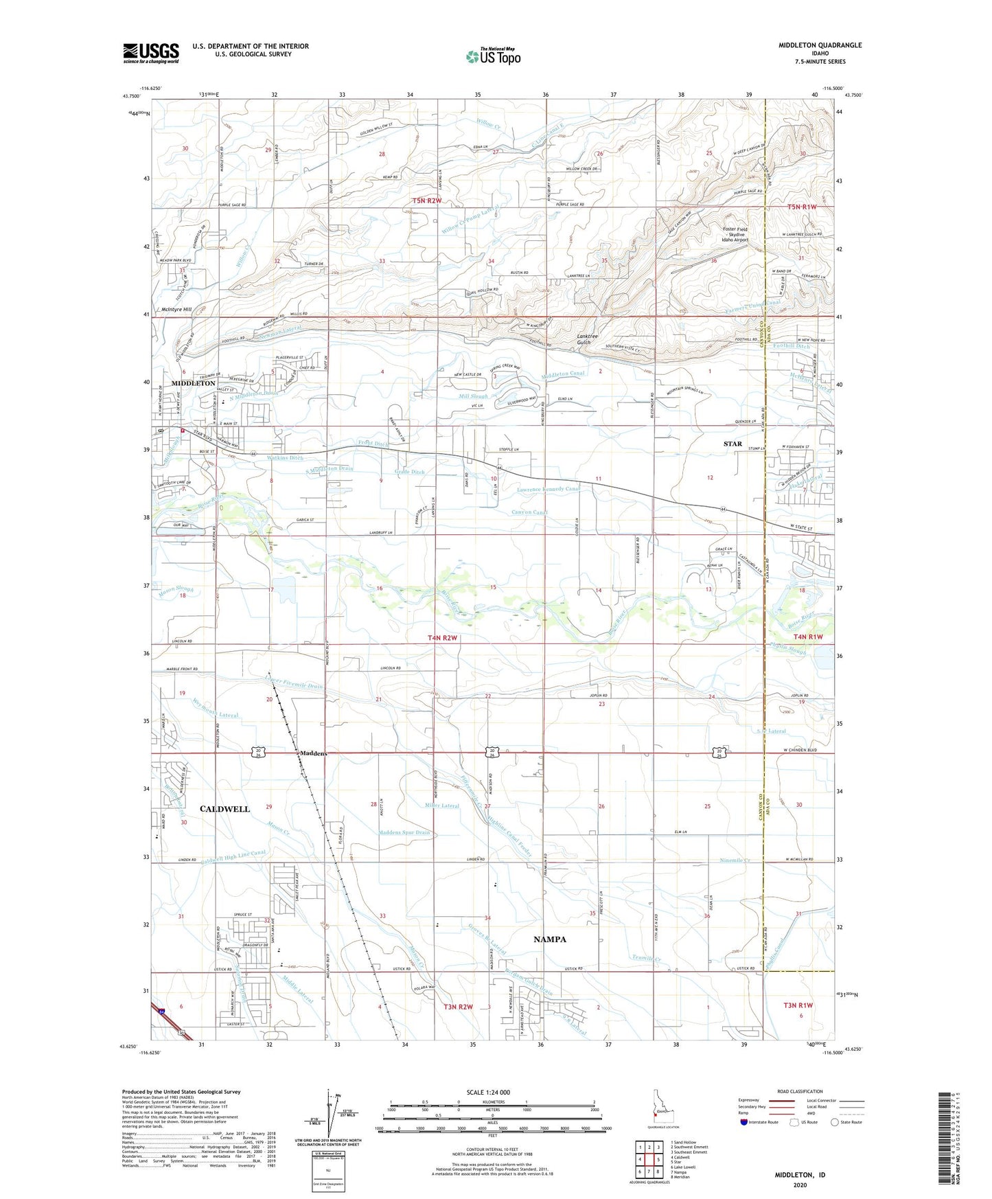
2024 topographic map quadrangle Middleton in the state of Idaho. Scale: 1:24000. Based on the newly updated USGS 7.5' US Topo map series, this map is in the following counties: Canyon, Ada. The map contains contour data, water features, and other items you are used to seeing on USGS maps, but also has updated roads and other features. This is the next generation of topographic maps. Printed on high-quality waterproof paper with UV fade-resistant inks.
Quads adjacent to this one:
West: Caldwell
Northwest: Sand Hollow
North: Southwest Emmett
Northeast: Southeast Emmett
East: Star
Southeast: Meridian
South: Nampa
Southwest: Lake Lowell
This map covers the same area as the classic USGS quad with code o43116f5.
Contains the following named places: 5.17 Lateral, 5.3 Lateral, 5.5 Lateral, 6.6 Lateral, Bolton Lateral, Caldwell High Line Canal, Canyon Canal, Central Park School, City of Middleton, Duff Lane Pond Public Fishing Area, East Canyon Elementary School, Fifteenmile Creek, Fivemile Creek, Flake Lateral, Foster Field - Skydive Idaho Airport, Franklin Labor Camp, Franklin School, Front Ditch, Grade Ditch, Groves Branch Lateral, Highline Canal Feeder, KBGN-AM (Caldwell), KIDH-AM (Eagle), KKIC-AM (Boise), Lanktree Gulch, Lone Tree School, Lower Fivemile Drain, Maddens, Maddens Spur Drain, Marble Front School, McHenry Lateral, McIntyre Hill, Middleton, Middleton Canal, Middleton Mill Ditch, Middleton Post Office, Middleton Rural Fire District Station 1, Miller Lateral, Newman Lateral, Noble Drain, North Middleton Drain, Phyllis Slough, Solomon Drain, South Middleton Drain, Tenmile Creek, Ward Memorial State Park, Watkins Ditch, Weymouth Lateral, Willow Creek Pump Lateral