MyTopo
Lake Lowell Idaho US Topo Map
Couldn't load pickup availability
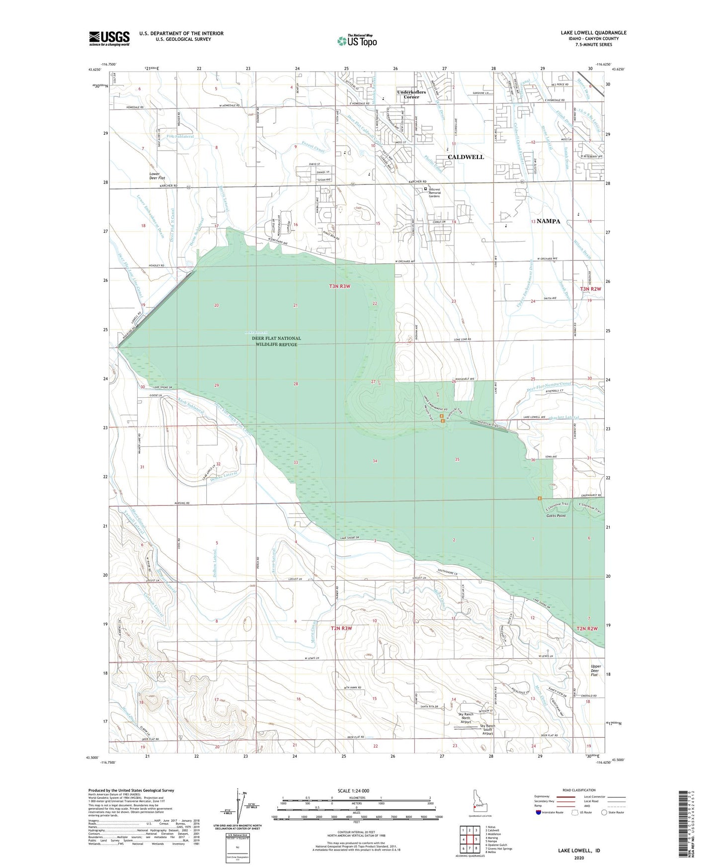
2023 topographic map quadrangle Lake Lowell in the state of Idaho. Scale: 1:24000. Based on the newly updated USGS 7.5' US Topo map series, this map is in the following counties: Canyon. The map contains contour data, water features, and other items you are used to seeing on USGS maps, but also has updated roads and other features. This is the next generation of topographic maps. Printed on high-quality waterproof paper with UV fade-resistant inks.
Quads adjacent to this one:
West: Marsing
Northwest: Notus
North: Caldwell
Northeast: Middleton
East: Nampa
Southeast: Melba
South: Givens Hot Springs
Southwest: Opalene Gulch
This map covers the same area as the classic USGS quad with code o43116e6.
Contains the following named places: Aven Lateral, Burris Lateral, Caldwell Canal Feeder, Carlson Lateral, Central Canyon Elementary School, Deer Flat Caldwell Canal, Deer Flat High Line Canal, Deer Flat Nampa Canal, Deer Flat National Wildlife Headquarters, Deer Flat National Wildlife Refuge, Deer Flat-Lower Dam, Deer Flat-Middle Dam, Deer Flat-Upper Dam, Demke Lateral, Demke Pipeline, Dolbow Lateral, Fenton Lateral, Forest Canal, Forest Pipeline, Gem State Adventist Academy, Gotts Point, Heine Sublateral, Hillcrest Memorial Gardens, Huston Division, Isaiah Drain, Jonah Drain, Knob Sublateral, Lake Lowell, Lake Lowell School, Lakeview School, Messler Lateral, Moses Drain, Sage Acres Race Track, Sky Ranch North Airport, Sky Ranch South Airport, Stewart Lateral, Stone Lateral, Thacker Lateral, Underkoflers Corner, Univ of Idaho Agr Experimental Station, Upper Embankment Drain, Vallivue High School, Vallivue Middle School, Wilson Drain, Wood Drain