MyTopo
Star Idaho US Topo Map
Couldn't load pickup availability
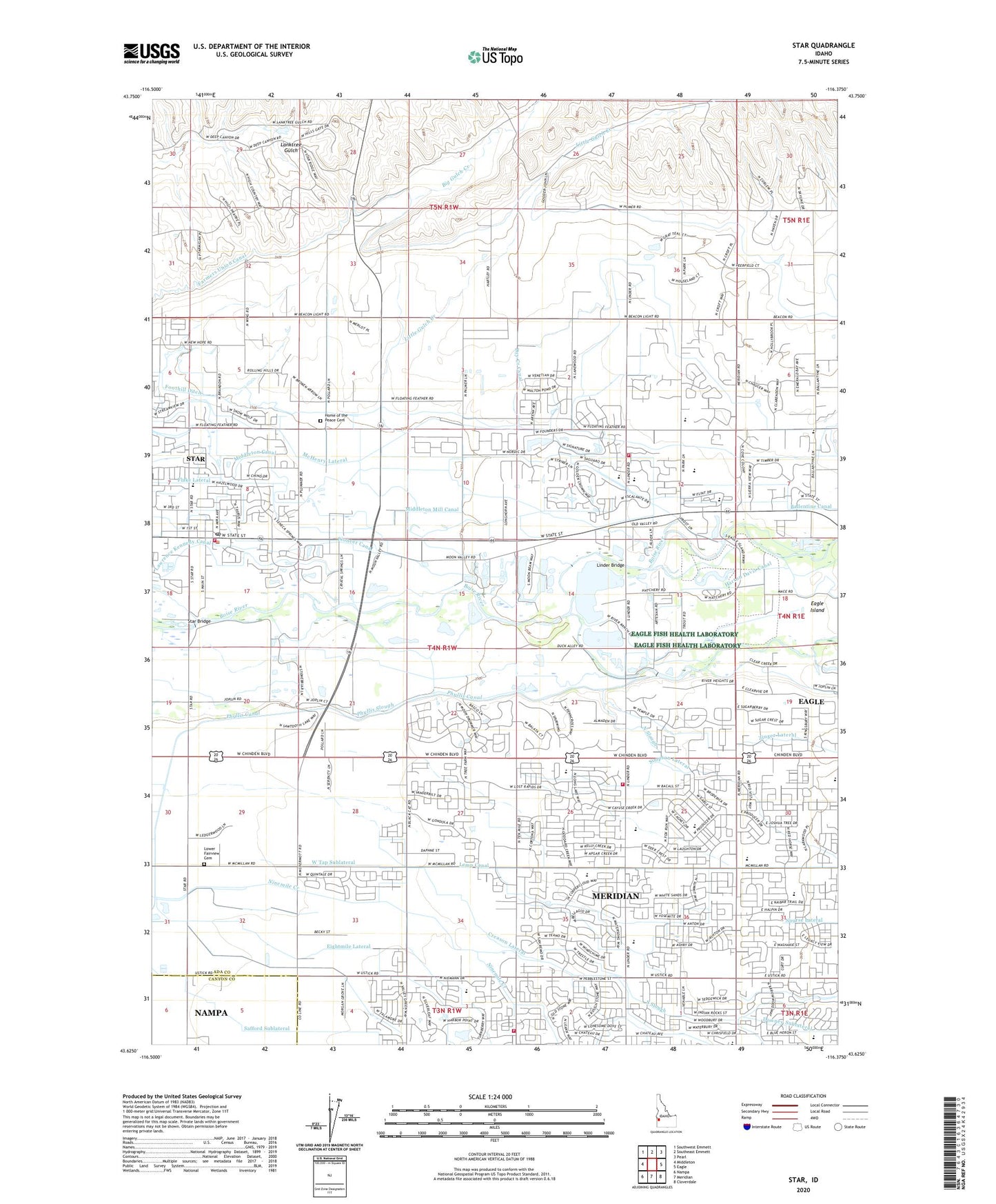
2024 topographic map quadrangle Star in the state of Idaho. Scale: 1:24000. Based on the newly updated USGS 7.5' US Topo map series, this map is in the following counties: Ada, Canyon. The map contains contour data, water features, and other items you are used to seeing on USGS maps, but also has updated roads and other features. This is the next generation of topographic maps. Printed on high-quality waterproof paper with UV fade-resistant inks.
Quads adjacent to this one:
West: Middleton
Northwest: Southwest Emmett
North: Southeast Emmett
Northeast: Pearl
East: Eagle
Southeast: Cloverdale
South: Meridian
Southwest: Nampa
This map covers the same area as the classic USGS quad with code o43116f4.
Contains the following named places: Ada County Paramedics Medical Station 61, Big Gulch Creek, Blue Valley School, Chief Joseph Elementary School, City of Eagle, City of Star, Creason Lateral, Eagle Division, Eagle Fire Protection District Station 3, Eagle Fish Health Laboratory, Eagle Hatchery, Eagle Island, Eagle Island Prison Farm, Eagle Island State Park, Fairview Church, Farmers Union Canal, Foothill Ditch, Harton Davis Canal, Home of the Peace Cemetery, Hunter Lateral, Lawrence Kennedy Canal, Lemp Canal, Linder Bridge, Little Gulch Creek, Lower Fairview Cemetery, Lower Fairview School, Meridian Fire Department Station 2, Meridian Fire Department Station 5, Middleton Mill Canal, Ninemile Creek, North Slough, Pioneer Canal, Pleasant View School, Safford Sublateral, Seven Suckers Ditch, Simpson Lateral, South Slough, Star, Star Bridge, Star Elementary School, Star Joint Fire Protection District, Star Post Office, Upper Fairview School, West Tap Sublateral, Young Heliport, ZIP Codes: 83646, 83669