MyTopo
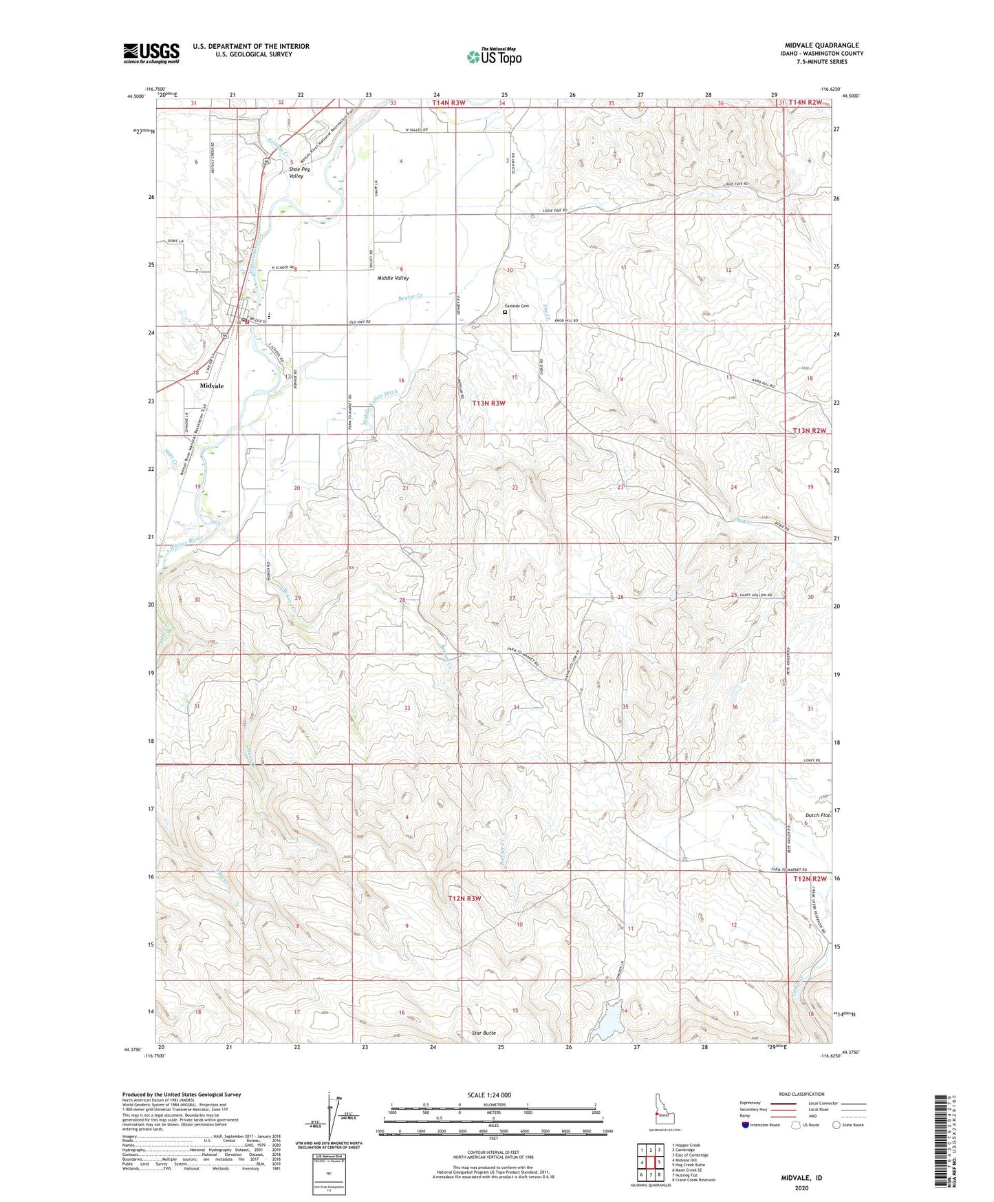
Midvale Idaho US Topo Map
Couldn't load pickup availability
2024 topographic map quadrangle Midvale in the state of Idaho. Scale: 1:24000. Based on the newly updated USGS 7.5' US Topo map series, this map is in the following counties: Washington. The map contains contour data, water features, and other items you are used to seeing on USGS maps, but also has updated roads and other features. This is the next generation of topographic maps. Printed on high-quality waterproof paper with UV fade-resistant inks.
Quads adjacent to this one:
West: Midvale Hill
Northwest: Hopper Creek
North: Cambridge
Northeast: East of Cambridge
East: Hog Creek Butte
Southeast: Crane Creek Reservoir
South: Nutmeg Flat
Southwest: Mann Creek SE
This map covers the same area as the classic USGS quad with code o44116d6.
Contains the following named places: Banner Creek, Beaver Creek, City of Midvale, Dry Creek, Eastside Cemetery, Keithly Creek, Little Crane Creek Dam, Little Crane Creek Reservoir, Middle Valley, Midvale, Midvale Alternative School, Midvale Elementary School, Midvale Fire District, Midvale High School, Midvale Junior - Senior High School, Midvale Post Office, Midvale School Danny Warfield Memorial Gymnasium, Midvale School Music Building, Midvale School Professional-Technical Building, Pole Creek, Sage Creek, She Creek, Shoe Peg Valley, Star Butte