MyTopo
Milner Idaho US Topo Map
Couldn't load pickup availability
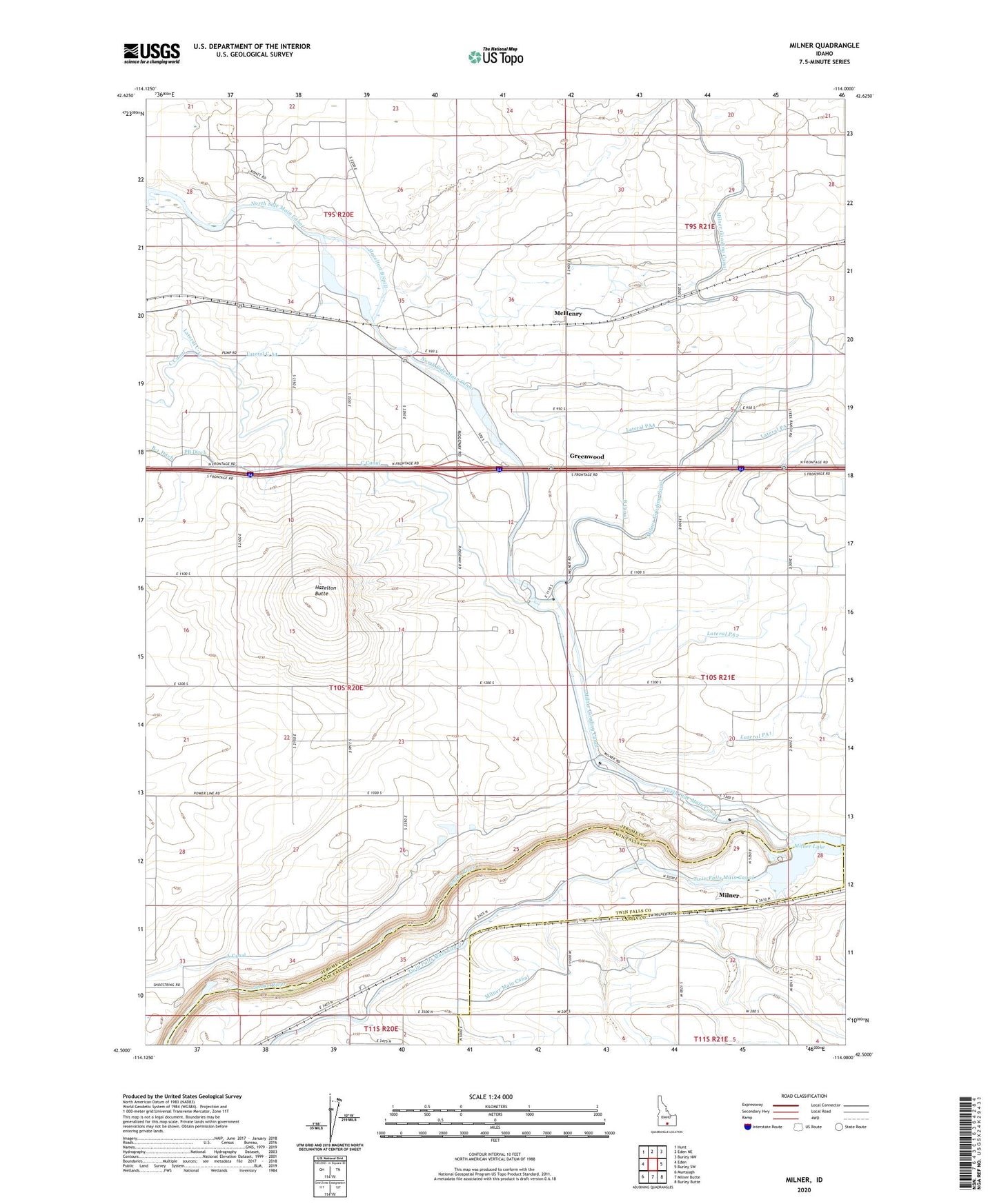
2023 topographic map quadrangle Milner in the state of Idaho. Scale: 1:24000. Based on the newly updated USGS 7.5' US Topo map series, this map is in the following counties: Jerome, Cassia, Twin Falls. The map contains contour data, water features, and other items you are used to seeing on USGS maps, but also has updated roads and other features. This is the next generation of topographic maps. Printed on high-quality waterproof paper with UV fade-resistant inks.
Quads adjacent to this one:
West: Eden
Northwest: Hunt
North: Eden NE
Northeast: Burley NW
East: Burley SW
Southeast: Burley Butte
South: Milner Butte
Southwest: Murtaugh
This map covers the same area as the classic USGS quad with code o42114e1.
Contains the following named places: A Canal, B Canal, Bypass Canal, Bypass Hydroelectric Facility, C Lateral, Caldron Linn, Greenwood, Hazelton A Hydroelectric Facility, Hazelton B Spill, Hazelton Butte, Lateral C-11, Lateral C-54, Lateral PA, Lateral PA1, Lateral PA2, Lateral PA2 Spill, Lateral PA4, Lateral PA5, McHenry, Milner, Milner Dam, Milner Historical Recreation Area, Milner Lake, Milner Station, P A Lateral, Parsons, ZIP Code: 83335