MyTopo
Murtaugh Idaho US Topo Map
Couldn't load pickup availability
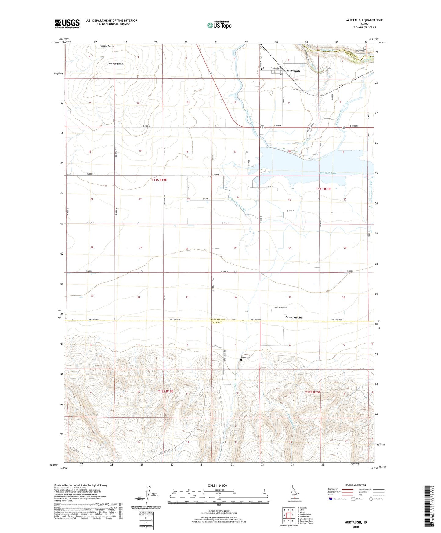
2024 topographic map quadrangle Murtaugh in the state of Idaho. Scale: 1:24000. Based on the newly updated USGS 7.5' US Topo map series, this map is in the following counties: Twin Falls, Cassia, Jerome. The map contains contour data, water features, and other items you are used to seeing on USGS maps, but also has updated roads and other features. This is the next generation of topographic maps. Printed on high-quality waterproof paper with UV fade-resistant inks.
Quads adjacent to this one:
West: Stricker Butte
Northwest: Kimberly
North: Eden
Northeast: Milner
East: Milner Butte
Southeast: Buckhorn Canyon
South: Rams Horn Ridge
Southwest: Grand View Peak
This map covers the same area as the classic USGS quad with code o42114d2.
Contains the following named places: Artesian City, Artesian Substation, Big Cottonwood Creek, Bower Cemetery, Caldron Linn, City of Murtaugh, Cold Spring Creek, Dry Creek, Hansen Butte, Murtaugh, Murtaugh Division, Murtaugh Elementary School, Murtaugh High School, Murtaugh Lake, Murtaugh Lake Access Area, Murtaugh Lake County Park, Murtaugh Lake Dam, Murtaugh Middle School, Murtaugh Post Office, ZIP Code: 83344