MyTopo
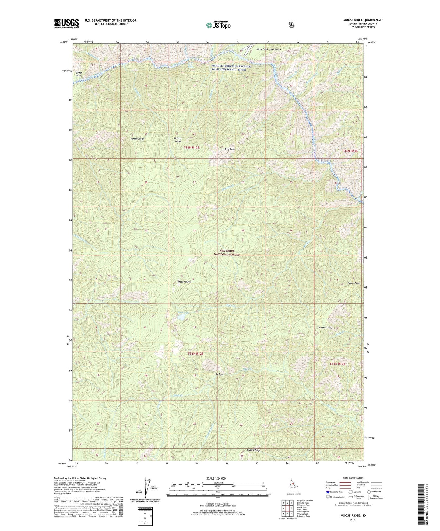
Moose Ridge Idaho US Topo Map
Couldn't load pickup availability
Also explore the Moose Ridge Forest Service Topo of this same quad for updated USFS data
2024 topographic map quadrangle Moose Ridge in the state of Idaho. Scale: 1:24000. Based on the newly updated USGS 7.5' US Topo map series, this map is in the following counties: Idaho. The map contains contour data, water features, and other items you are used to seeing on USGS maps, but also has updated roads and other features. This is the next generation of topographic maps. Printed on high-quality waterproof paper with UV fade-resistant inks.
Quads adjacent to this one:
West: Mink Peak
Northwest: Big Rock Mountain
North: Shissler Peak
Northeast: Freeman Peak
East: Dog Creek
Southeast: Gardiner Peak
South: Wylies Peak
Southwest: Running Lake
This map covers the same area as the classic USGS quad with code o46114a8.
Contains the following named places: Bitch Creek, Bitch Lake, Cedar Flats, Cedar Flats Campground, Clamp Creek, Divide Creek, Dog Creek, Double Drop Rapids, Fox Creek, Fox Park, Grizzly Saddle, Halfway Creek, Hell Creek, Hopwood Creek, Jake Creek, Lonesome Creek, Magpie Creek, Moose Creek, Moose Ridge, Parsell Point, Patrol Point, Puzzle Creek, Shearer Peak, Tony Creek, Tony Point