MyTopo
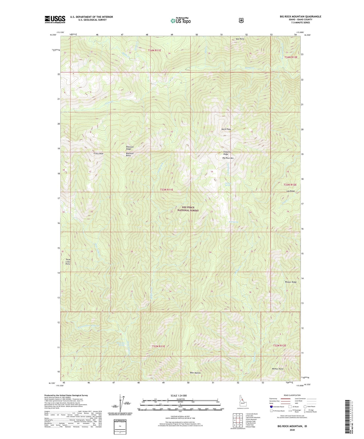
Big Rock Mountain Idaho US Topo Map
Couldn't load pickup availability
Also explore the Big Rock Mountain Forest Service Topo of this same quad for updated USFS data
2024 topographic map quadrangle Big Rock Mountain in the state of Idaho. Scale: 1:24000. Based on the newly updated USGS 7.5' US Topo map series, this map is in the following counties: Idaho. The map contains contour data, water features, and other items you are used to seeing on USGS maps, but also has updated roads and other features. This is the next generation of topographic maps. Printed on high-quality waterproof paper with UV fade-resistant inks.
Quads adjacent to this one:
West: Fenn Mountain
Northwest: Greenside Butte
North: Fish Lake
Northeast: McConnell Mountain
East: Shissler Peak
Southeast: Moose Ridge
South: Mink Peak
Southwest: Fog Mountain
This map covers the same area as the classic USGS quad with code o46115b1.
Contains the following named places: Bear Wallow, Big Rock Mountain, Blacktail Butte, Blacktail Ridge, Frisco Peak, Grotto Creek, High Spring, Lizard Creek, Meeker Point, Meeker Ridge, North Peak, Parsons Spring, Saddle Fork, Sixtytwo Ranger Station, Sixtytwo Ridge, Sled Creek, Stuart Hot Springs, Three Links Point, West Fork Three Links Creek, Wounded Doe Creek