MyTopo
Stricker Butte Idaho US Topo Map
Couldn't load pickup availability
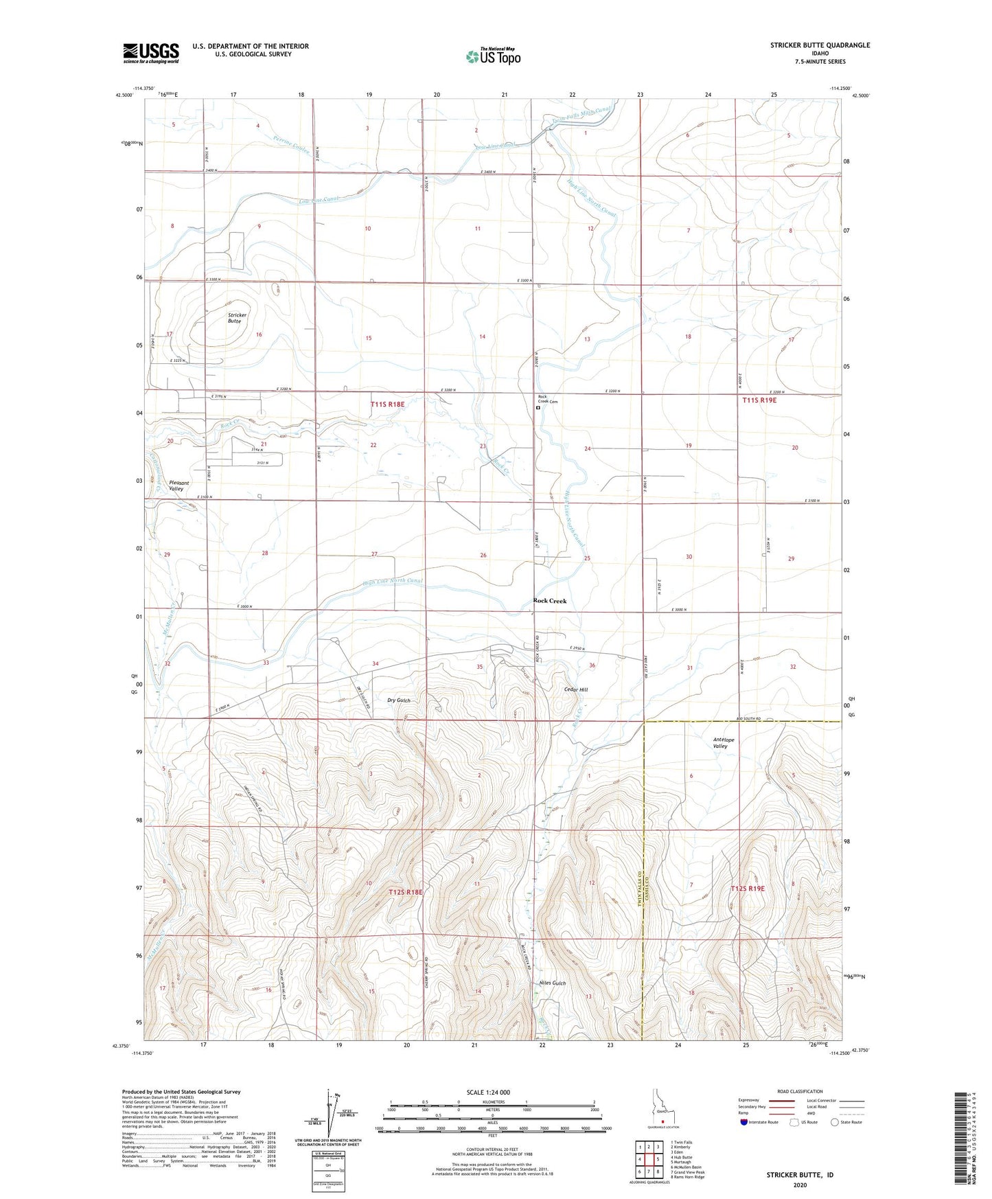
2023 topographic map quadrangle Stricker Butte in the state of Idaho. Scale: 1:24000. Based on the newly updated USGS 7.5' US Topo map series, this map is in the following counties: Twin Falls, Cassia. The map contains contour data, water features, and other items you are used to seeing on USGS maps, but also has updated roads and other features. This is the next generation of topographic maps. Printed on high-quality waterproof paper with UV fade-resistant inks.
Quads adjacent to this one:
West: Hub Butte
Northwest: Twin Falls
North: Kimberly
Northeast: Eden
East: Murtaugh
Southeast: Rams Horn Ridge
South: Grand View Peak
Southwest: McMullen Basin
This map covers the same area as the classic USGS quad with code o42114d3.
Contains the following named places: Antelope Valley, Cedar Hill, Dry Gulch, Magic Milk Dairy, McMullen Creek, Niles Gulch, Pleasant Valley, Pleasant Valley School, Rock Creek, Rock Creek Cemetery, Stricker Butte, Stricker Cabin, Striker, Sudik Dairy, ZIP Codes: 83334, 83341