MyTopo
North Laidlaw Butte Idaho US Topo Map
Couldn't load pickup availability
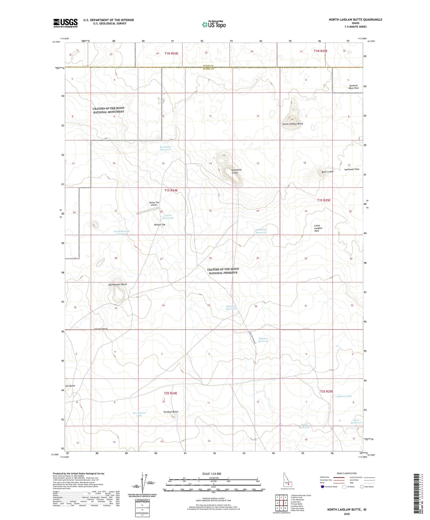
2024 topographic map quadrangle North Laidlaw Butte in the state of Idaho. Scale: 1:24000. Based on the newly updated USGS 7.5' US Topo map series, this map is in the following counties: Blaine, Butte. The map contains contour data, water features, and other items you are used to seeing on USGS maps, but also has updated roads and other features. This is the next generation of topographic maps. Printed on high-quality waterproof paper with UV fade-resistant inks.
Quads adjacent to this one:
West: Little Park
Northwest: Blizzard Mountain South
North: Inferno Cone
Northeast: The Watchman
East: Fissure Butte
Southeast: Bear Park West
South: Bear Den Butte
Southwest: Laidlaw Butte
This map covers the same area as the classic USGS quad with code o43113c5.
Contains the following named places: Ant Butte, Big Blowout Butte, Blowout Reservoir, Bowl Crater, Bullshot Reservoir, Carey Division, Ellsworth Well, Erwin Reservoir, Hawk Reservoir, Hollow Top, Hollow Top Airport, Little Laidlaw Park, North Blowout Reservoir, North End Indian Well, North Laidlaw Butte, North Pole Lake, Northside Reservoir, Snowdrift Crater, Snowdrift Reservoir, Spencer Lake, Turnbull Butte, Two Bottom Lake