MyTopo
Oreana Idaho US Topo Map
Couldn't load pickup availability
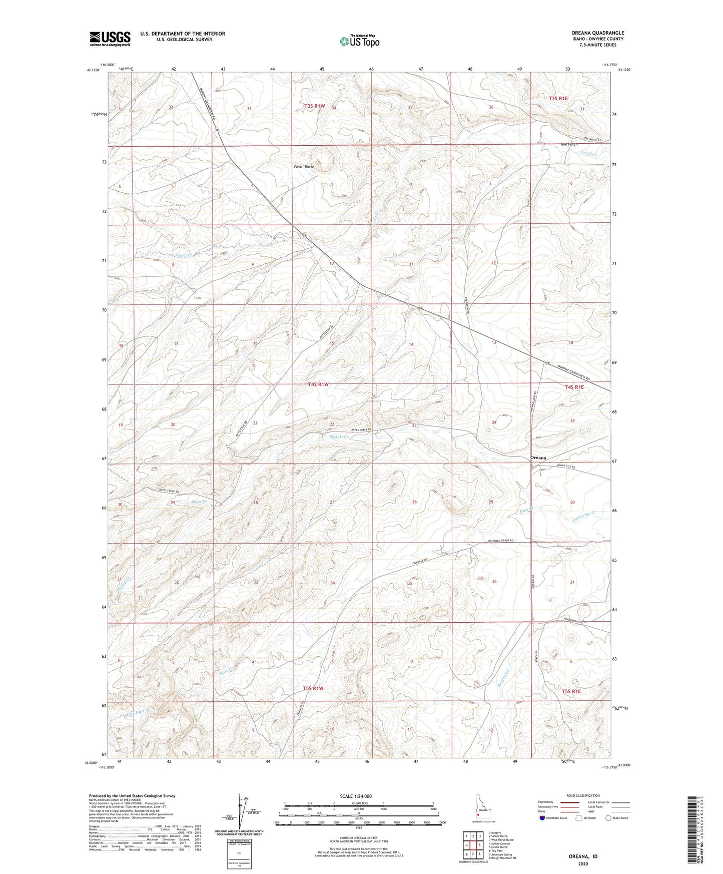
2023 topographic map quadrangle Oreana in the state of Idaho. Scale: 1:24000. Based on the newly updated USGS 7.5' US Topo map series, this map is in the following counties: Owyhee. The map contains contour data, water features, and other items you are used to seeing on USGS maps, but also has updated roads and other features. This is the next generation of topographic maps. Printed on high-quality waterproof paper with UV fade-resistant inks.
Quads adjacent to this one:
West: Sinker Canyon
Northwest: Murphy
North: Sinker Butte
Northeast: Wild Horse Butte
East: Castle Butte
Southeast: Rough Mountain NE
South: Antelope Spring
Southwest: Toy Pass
This map covers the same area as the classic USGS quad with code o43116a4.
Contains the following named places: Bates Creek, Fossil Butte, Hart Creek, Little Hart Creek, Oreana, Oreana School, Pickett Creek, Rye Patch