MyTopo
Sinker Canyon Idaho US Topo Map
Couldn't load pickup availability
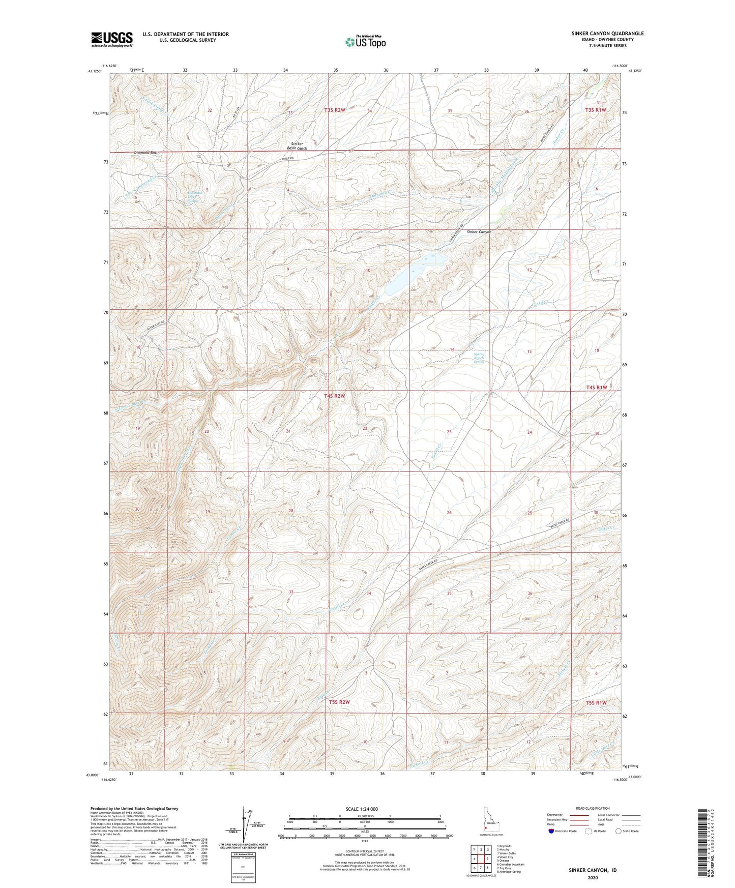
2023 topographic map quadrangle Sinker Canyon in the state of Idaho. Scale: 1:24000. Based on the newly updated USGS 7.5' US Topo map series, this map is in the following counties: Owyhee. The map contains contour data, water features, and other items you are used to seeing on USGS maps, but also has updated roads and other features. This is the next generation of topographic maps. Printed on high-quality waterproof paper with UV fade-resistant inks.
Quads adjacent to this one:
West: Silver City
Northwest: Reynolds
North: Murphy
Northeast: Sinker Butte
East: Oreana
Southeast: Antelope Spring
South: Toy Pass
Southwest: Cinnabar Mountain
This map covers the same area as the classic USGS quad with code o43116a5.
Contains the following named places: Diamond Basin, Diamond Creek, Diamond Creek Spring, East Fork Sinker Creek, Gerdie Creek, Gilmore Ranch, Hulet Dam, Hulet-Sinker Creek Reservoir, North Fork Sinker Creek, Pedracini Fork, Sinker, Sinker Canyon, South Fork Diamond Creek, South Fork Sinker Creek, Spring Ranch, Spring Ranch Spring