MyTopo
Sawmill Creek Idaho US Topo Map
Couldn't load pickup availability
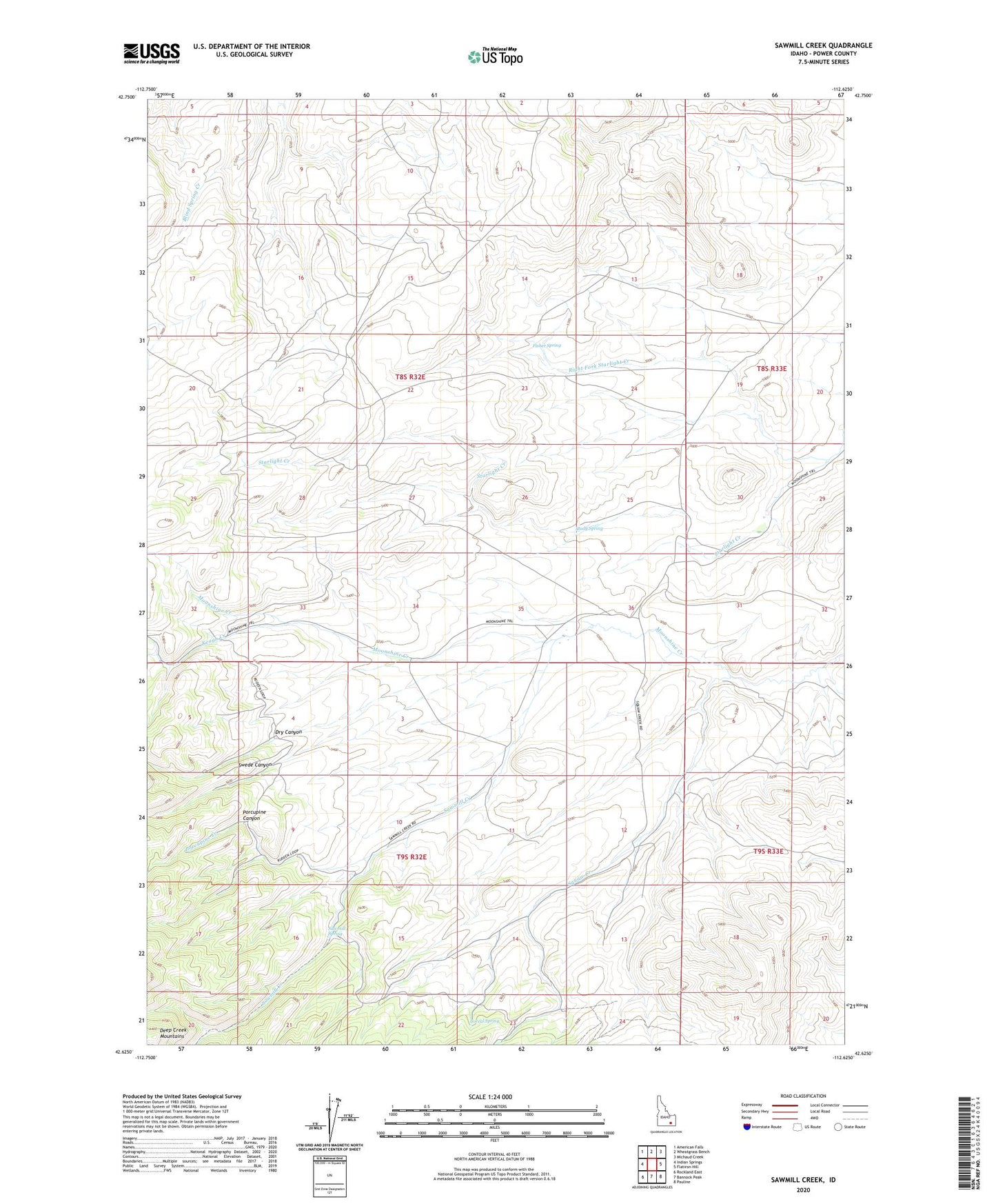
2023 topographic map quadrangle Sawmill Creek in the state of Idaho. Scale: 1:24000. Based on the newly updated USGS 7.5' US Topo map series, this map is in the following counties: Power. The map contains contour data, water features, and other items you are used to seeing on USGS maps, but also has updated roads and other features. This is the next generation of topographic maps. Printed on high-quality waterproof paper with UV fade-resistant inks.
Quads adjacent to this one:
West: Indian Springs
Northwest: American Falls
North: Wheatgrass Bench
Northeast: Michaud Creek
East: Flatiron Hill
Southeast: Pauline
South: Bannock Peak
Southwest: Rockland East
This map covers the same area as the classic USGS quad with code o42112f6.
Contains the following named places: Corral Spring, Dry Canyon, Fisher Spring, Keogh Creek, Porcupine Canyon, Porcupine Creek, Right Fork Starlight Creek, Sawmill Creek, Sawmill Spring, Squaw Creek, Study Spring, Swede Canyon