MyTopo
Weippe South Idaho US Topo Map
Couldn't load pickup availability
Also explore the Weippe South Forest Service Topo of this same quad for updated USFS data
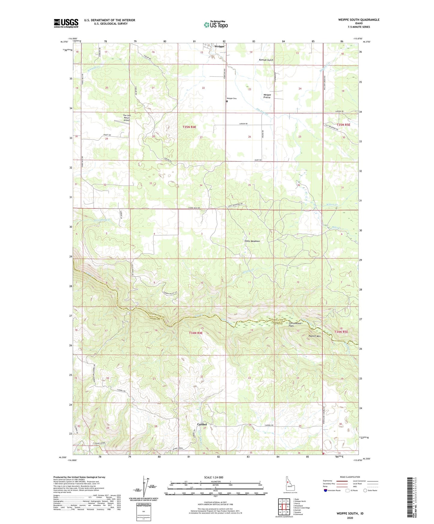
2024 topographic map quadrangle Weippe South in the state of Idaho. Scale: 1:24000. Based on the newly updated USGS 7.5' US Topo map series, this map is in the following counties: Clearwater, Idaho. The map contains contour data, water features, and other items you are used to seeing on USGS maps, but also has updated roads and other features. This is the next generation of topographic maps. Printed on high-quality waterproof paper with UV fade-resistant inks.
Quads adjacent to this one:
West: Woodland
Northwest: Rudo
North: Weippe North
Northeast: Pierce
East: Brown Creek Ridge
Southeast: Glenwood
South: Kooskia
Southwest: Kamiah
This map covers the same area as the classic USGS quad with code o46115c8.
Contains the following named places: Caribel, Cottonwood Flats, Crocker Creek, Glenwood - Caribel Volunteer Fire District, Grouse Creek, Heywood Creek, Jacobson, Kamiah Gulch, Miles Creek, Paunch Mountain, State Meadows, The Last Resort Airport, Weippe Cemetery, Weippe Prairie, Wilson Creek