MyTopo
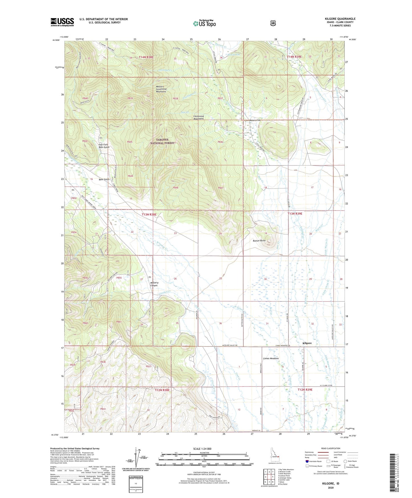
Kilgore Idaho US Topo Map
Couldn't load pickup availability
Also explore the Kilgore Forest Service Topo of this same quad for updated USFS data
2023 topographic map quadrangle Kilgore in the state of Idaho. Scale: 1:24000. Based on the newly updated USGS 7.5' US Topo map series, this map is in the following counties: Clark. The map contains contour data, water features, and other items you are used to seeing on USGS maps, but also has updated roads and other features. This is the next generation of topographic maps. Printed on high-quality waterproof paper with UV fade-resistant inks.
Quads adjacent to this one:
West: Lookout Point
Northwest: Big Table Mountain
North: Winslow Creek
Northeast: Slide Mountain
East: Antelope Valley
Southeast: Pine Butte
South: Idmon
Southwest: Gardner Lake
This map covers the same area as the classic USGS quad with code o44111d8.
Contains the following named places: Bear Gulch, Button Butte, Camas Meadows, Ching Creek, Dry Creek, East Camos Campground, East Fork Bear Gulch, Fryingpan Creek, Hirschi Flat, Kay Creek, Kilgore, Larkspur Creek, Little Ching Creek, Little Warm Creek, McGarry Canyon, Pasture Creek, Saw Creek, Spruce Creek, Warm Creek, Waters Flat