MyTopo
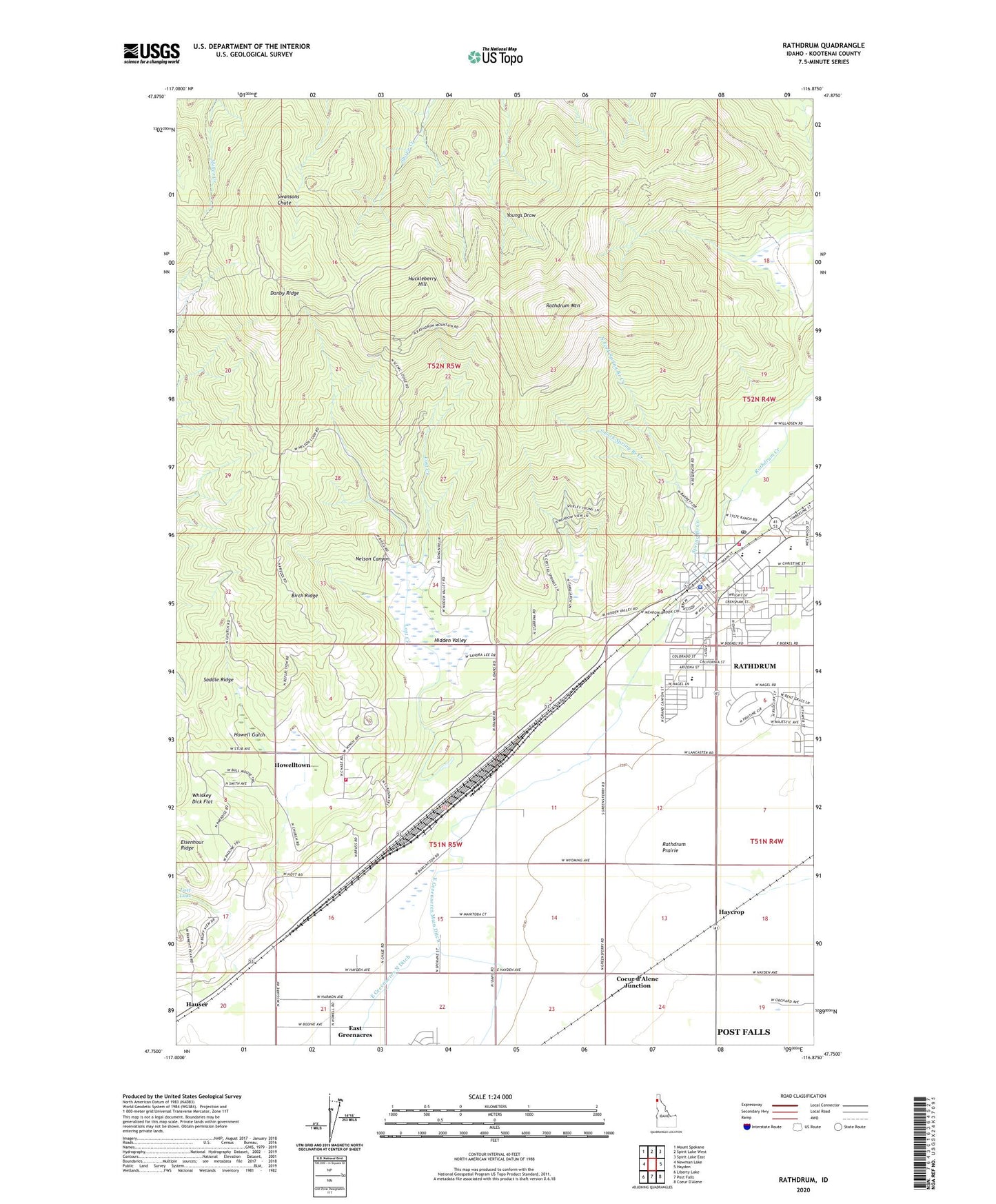
Rathdrum Idaho US Topo Map
Couldn't load pickup availability
Also explore the Rathdrum Forest Service Topo of this same quad for updated USFS data
2024 topographic map quadrangle Rathdrum in the state of Idaho. Scale: 1:24000. Based on the newly updated USGS 7.5' US Topo map series, this map is in the following counties: Kootenai. The map contains contour data, water features, and other items you are used to seeing on USGS maps, but also has updated roads and other features. This is the next generation of topographic maps. Printed on high-quality waterproof paper with UV fade-resistant inks.
Quads adjacent to this one:
West: Newman Lake
Northwest: Mount Spokane
North: Spirit Lake West
Northeast: Spirit Lake East
East: Hayden
South: Post Falls
Southwest: Liberty Lake
This map covers the same area as the classic USGS quad with code o47116g8.
Contains the following named places: Birch Ridge, City of Rathdrum, Coeur d'Alene Junction, Danby Ridge, East Greenacres, East Greenacres Main Ditch, East Greenacres North Ditch, Eisenhour Ridge, Four Corners, Haycrop, Hidden Valley, Howell Gulch, Howelltown, Huckleberry Hill, John Brown Elementary School, Lakeland Junior High School, Lakeland Senior High School, Lakeland Shopping Center, Lost Creek, Nelson Canyon, North Fork Spring Branch Creek, Northern Lakes Fire Protection District Station 2, Northern Lakes Fire Protection District Station 6, Post Falls-Rathdrum Division, Rathdrum, Rathdrum Creek, Rathdrum Elementary School, Rathdrum Mountain, Rathdrum Police Department, Rathdrum Post Office, Rathdrum Upper Elementary School, Scenic Lodge, South Fork Spring Branch Creek, Spring Branch Creek, Whiskey Dick Flat, ZIP Code: 83858