MyTopo
Priest Lake NE Idaho US Topo Map
Couldn't load pickup availability
Also explore the Priest Lake NE Forest Service Topo of this same quad for updated USFS data
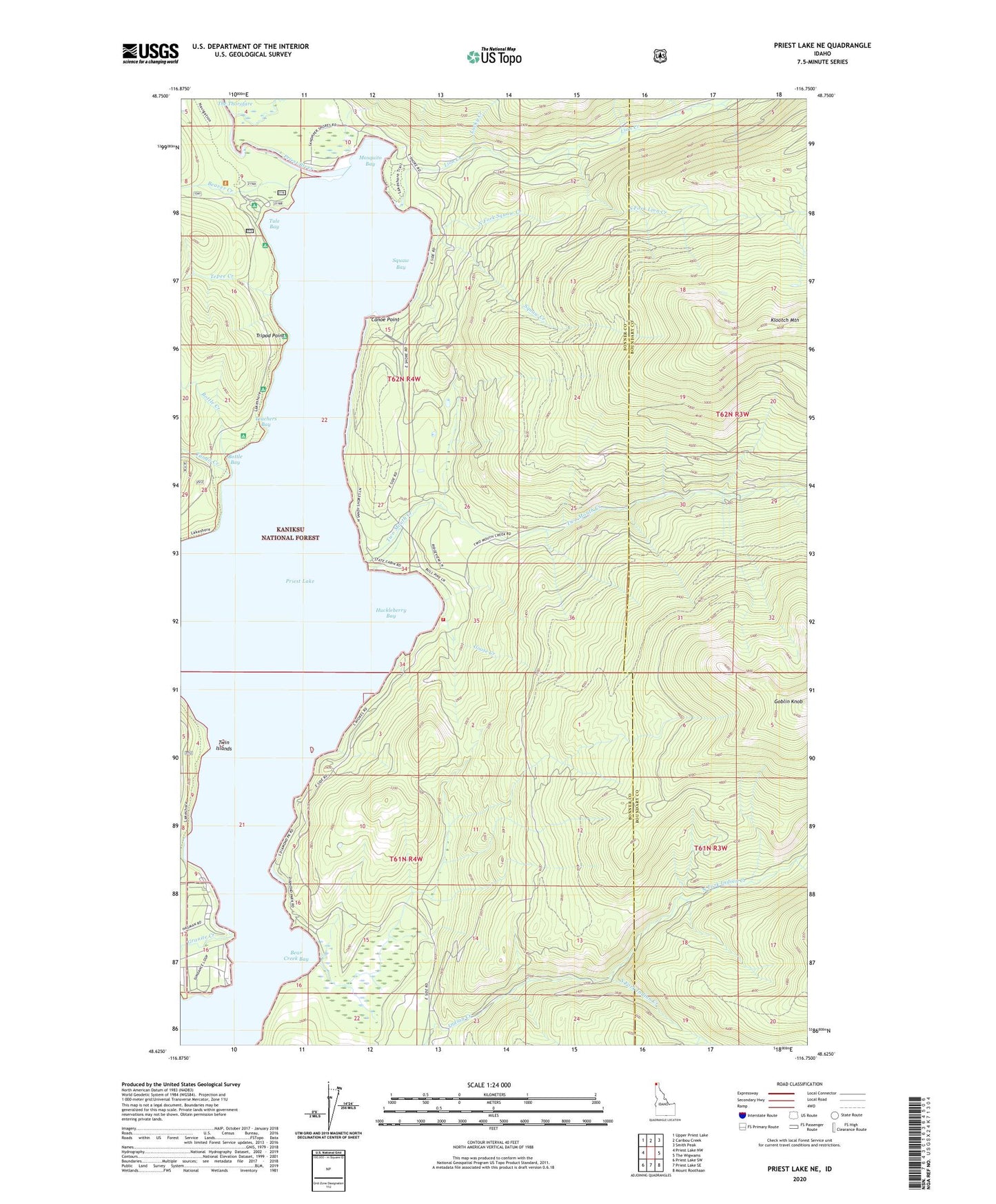
2024 topographic map quadrangle Priest Lake NE in the state of Idaho. Scale: 1:24000. Based on the newly updated USGS 7.5' US Topo map series, this map is in the following counties: Bonner, Boundary. The map contains contour data, water features, and other items you are used to seeing on USGS maps, but also has updated roads and other features. This is the next generation of topographic maps. Printed on high-quality waterproof paper with UV fade-resistant inks.
Quads adjacent to this one:
West: Priest Lake NW
Northwest: Upper Priest Lake
North: Caribou Creek
Northeast: Smith Peak
East: The Wigwams
Southeast: Mount Roothaan
South: Priest Lake SE
Southwest: Priest Lake SW
This map covers the same area as the classic USGS quad with code o48116f7.
Contains the following named places: Bear Creek, Bear Creek Bay, Beaver Creek, Beaver Creek Recreation Site, Bottle Bay, Bottle Creek, Camp Codge, Canoe Point, Caribou Creek, Distillery Bay, Goose Creek, Granite Creek, Huckleberry Bay, Klootch Mountain, Lion Creek, Lionhead Recretaion Site, Lucky Creek, Mosquito Bay, North Fork Indian Creek, North Fork Squaw Creek, North of the Narrows Fire District, Priest Lake State Park Lionhead Unit, South Fork Indian Creek, South Fork Lion Creek, Squaw Bay, Squaw Creek, Tango Creek, Teachers Bay, Tepee Creek, Tepee Creek Research Natural Area, The Thorofare, Tripod Point, Tule Bay, Twin Islands, Two Mouth Creek, Two Mouth Guard Station