MyTopo
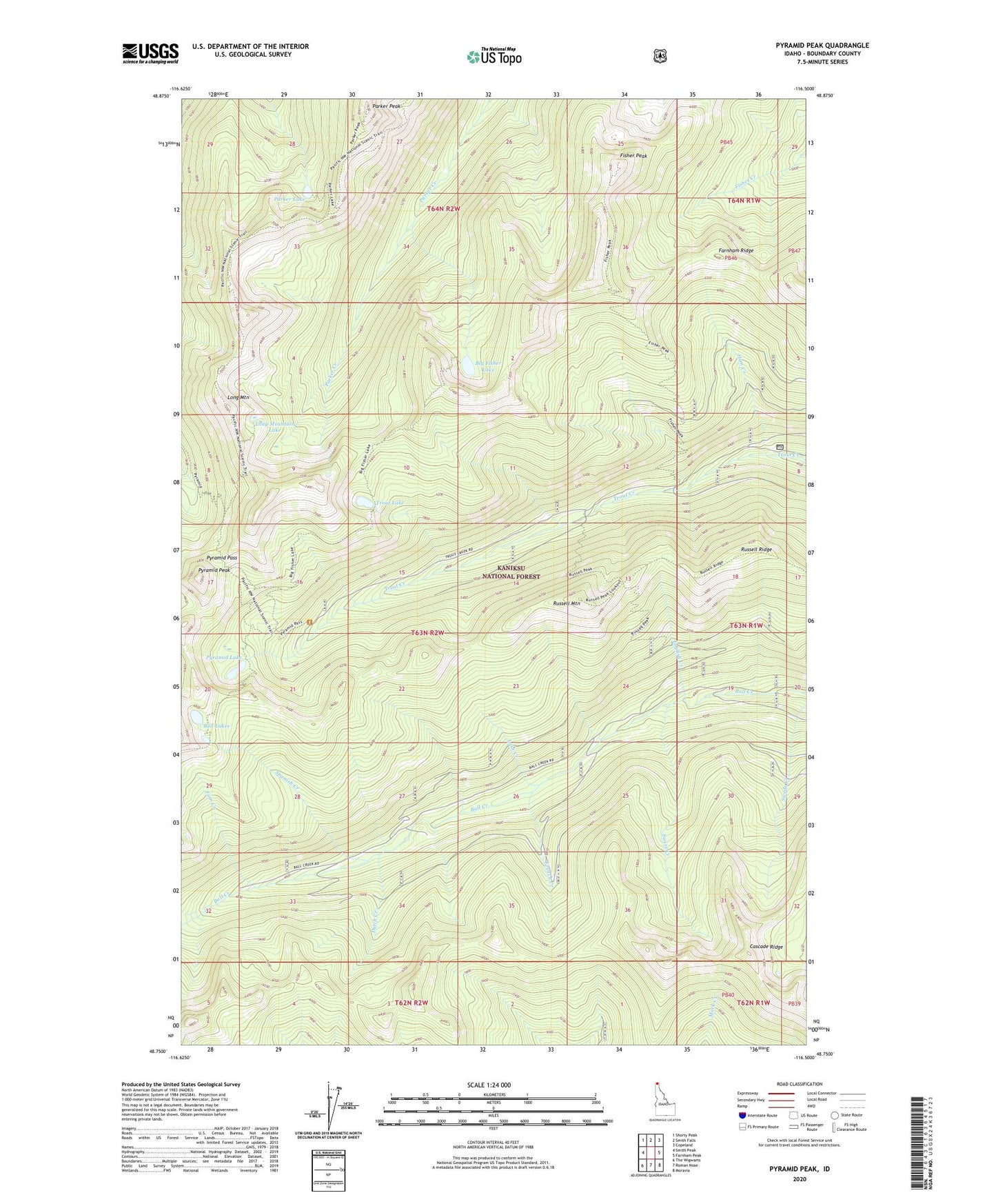
Pyramid Peak Idaho US Topo Map
Couldn't load pickup availability
Also explore the Pyramid Peak Forest Service Topo of this same quad for updated USFS data
2024 topographic map quadrangle Pyramid Peak in the state of Idaho. Scale: 1:24000. Based on the newly updated USGS 7.5' US Topo map series, this map is in the following counties: Boundary. The map contains contour data, water features, and other items you are used to seeing on USGS maps, but also has updated roads and other features. This is the next generation of topographic maps. Printed on high-quality waterproof paper with UV fade-resistant inks.
Quads adjacent to this one:
West: Smith Peak
Northwest: Shorty Peak
North: Smith Falls
Northeast: Copeland
East: Farnham Peak
Southeast: Moravia
South: Roman Nose
Southwest: The Wigwams
This map covers the same area as the classic USGS quad with code o48116g5.
Contains the following named places: Ball Lakes, Big Fisher Lake, Cascade Ridge, Dutch Creek, English Creek, Farnham Ridge, Finn Creek, Fisher Peak, French Creek, Ham Creek, Irish Creek, Long Mountain, Long Mountain Lake, Parker Lake, Parker Peak, Pyramid Lake, Pyramid Pass, Pyramid Peak, Russell Mountain, Russell Mountain Lookout, Russell Ridge, Spanish Creek, Swiss Creek, Trout Lake, Turk Creek, ZIP Code: 83805