MyTopo
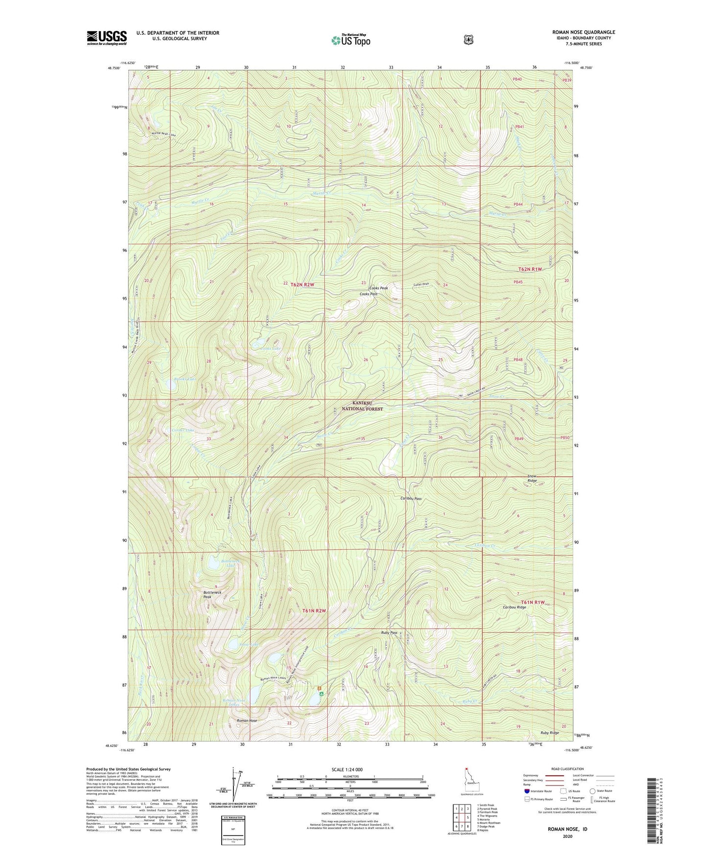
Roman Nose Idaho US Topo Map
Couldn't load pickup availability
Also explore the Roman Nose Forest Service Topo of this same quad for updated USFS data
2024 topographic map quadrangle Roman Nose in the state of Idaho. Scale: 1:24000. Based on the newly updated USGS 7.5' US Topo map series, this map is in the following counties: Boundary. The map contains contour data, water features, and other items you are used to seeing on USGS maps, but also has updated roads and other features. This is the next generation of topographic maps. Printed on high-quality waterproof paper with UV fade-resistant inks.
Quads adjacent to this one:
West: The Wigwams
Northwest: Smith Peak
North: Pyramid Peak
Northeast: Farnham Peak
East: Moravia
Southeast: Naples
South: Dodge Peak
Southwest: Mount Roothaan
This map covers the same area as the classic USGS quad with code o48116f5.
Contains the following named places: Adverse Creek, Beehive Creek, Bottleneck Lake, Bottleneck Peak, Brooks Lake, Caribou Pass, Cooks Creek, Cooks Lake, Cooks Pass, Cooks Peak, Corner Creek, Corner Lake, Frost Creek, Jim Creek, Mack Creek, Myrtle Creek Game Preserve, Peak Creek, Roman Nose, Roman Nose Lakes, Ruby Pass, Snow Lake, Snow Ridge, South and West Boundary Division, Toot Creek