MyTopo
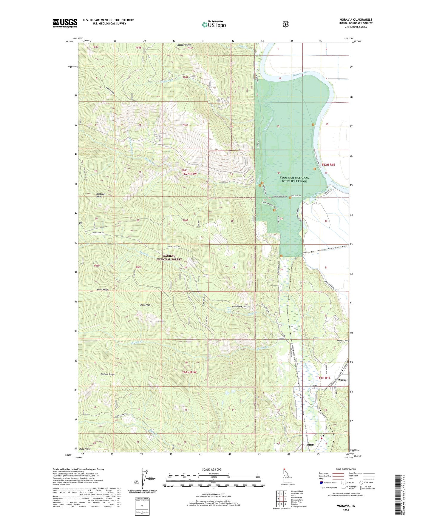
Moravia Idaho US Topo Map
Couldn't load pickup availability
Also explore the Moravia Forest Service Topo of this same quad for updated USFS data
2024 topographic map quadrangle Moravia in the state of Idaho. Scale: 1:24000. Based on the newly updated USGS 7.5' US Topo map series, this map is in the following counties: Boundary. The map contains contour data, water features, and other items you are used to seeing on USGS maps, but also has updated roads and other features. This is the next generation of topographic maps. Printed on high-quality waterproof paper with UV fade-resistant inks.
Quads adjacent to this one:
West: Roman Nose
Northwest: Pyramid Peak
North: Farnham Peak
Northeast: Ritz
East: Bonners Ferry
Southeast: Twentymile Creek
South: Naples
Southwest: Dodge Peak
This map covers the same area as the classic USGS quad with code o48116f4.
Contains the following named places: Burns, Caribou Creek, Caribou Ridge, Cascade Creek, Curve Creek, Deep Creek, Kootenai National Wildlife Refuge, Kootenai Point, Lost Creek, Moravia, Myrtle Creek, Snow Creek, Snow Creek Falls, Snow Peak, South Boundary Fire Protection District Station 2, Yellow Pine Creek