MyTopo
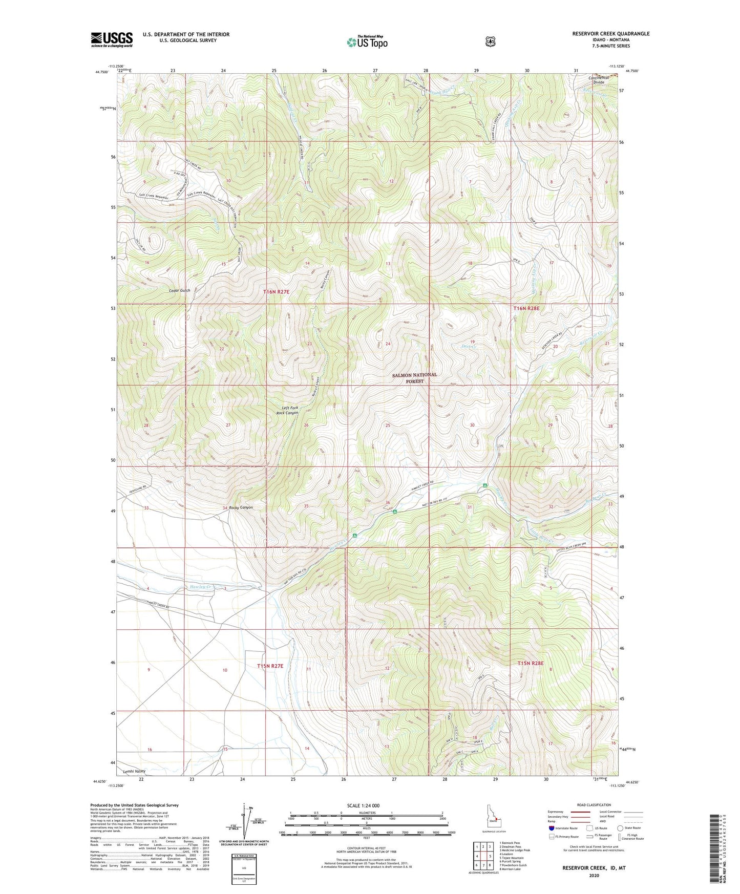
Reservoir Creek Idaho US Topo Map
Couldn't load pickup availability
Also explore the Reservoir Creek Forest Service Topo of this same quad for updated USFS data
2024 topographic map quadrangle Reservoir Creek in the states of Idaho, Montana. Scale: 1:24000. Based on the newly updated USGS 7.5' US Topo map series, this map is in the following counties: Lemhi, Beaverhead. The map contains contour data, water features, and other items you are used to seeing on USGS maps, but also has updated roads and other features. This is the next generation of topographic maps. Printed on high-quality waterproof paper with UV fade-resistant inks.
Quads adjacent to this one:
West: Leadore
Northwest: Bannock Pass
North: Deadman Pass
Northeast: Medicine Lodge Peak
East: Tepee Mountain
Southeast: Morrison Lake
South: Powderhorn Gulch
Southwest: Purcell Spring
Contains the following named places: Big Bear Creek, Bull Creek, Cabin Creek, Deer Creek, Left Fork Rock Canyon, Little Bear Creek, Lower Sweeney Mine, Quaking Asp Creek, Reservoir Creek, Rocky Canyon, Short Creek, Upper Sweeney Mine