MyTopo
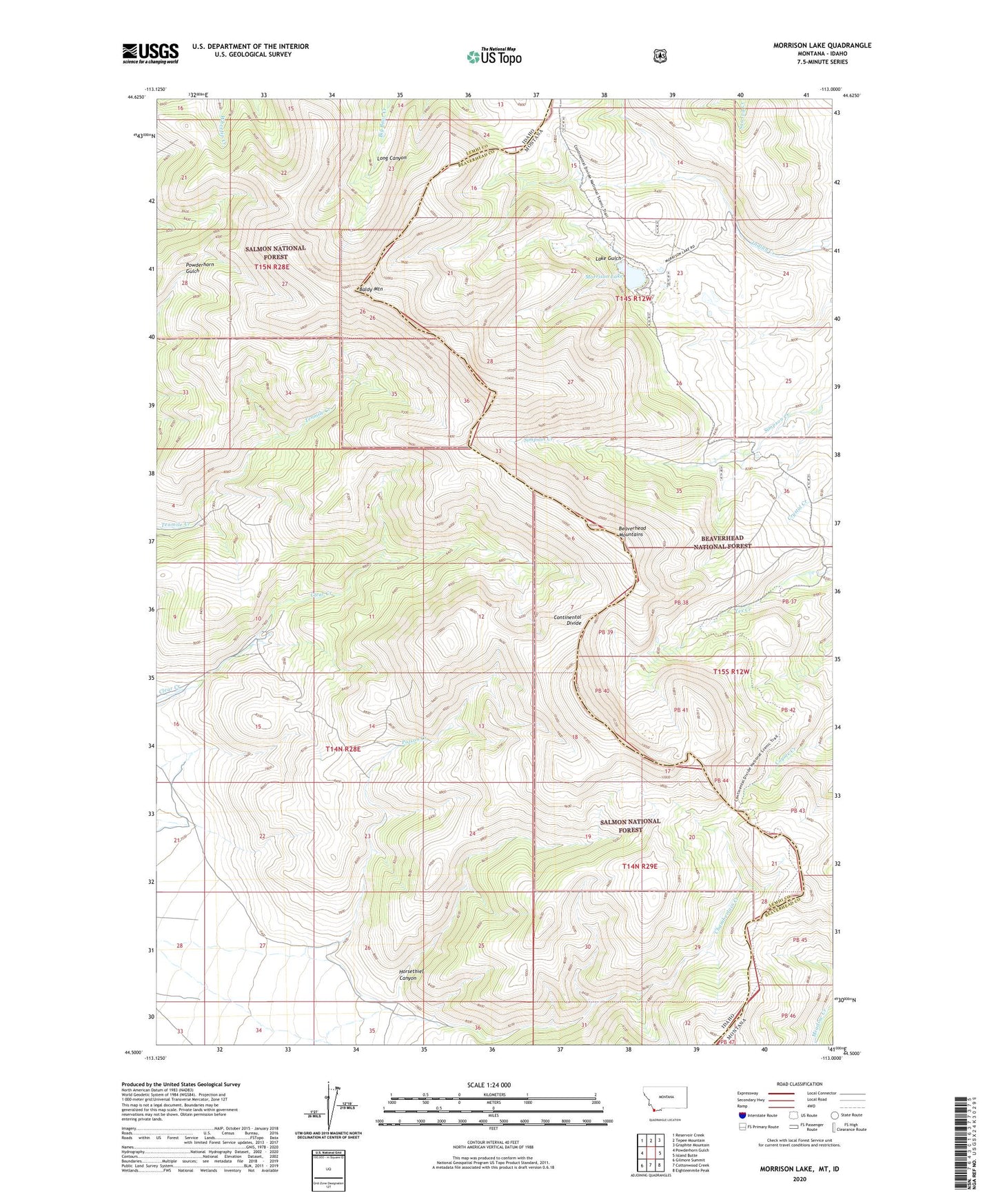
Morrison Lake Montana US Topo Map
Couldn't load pickup availability
Also explore the Morrison Lake Forest Service Topo of this same quad for updated USFS data
2024 topographic map quadrangle Morrison Lake in the states of Idaho, Montana. Scale: 1:24000. Based on the newly updated USGS 7.5' US Topo map series, this map is in the following counties: Beaverhead, Lemhi. The map contains contour data, water features, and other items you are used to seeing on USGS maps, but also has updated roads and other features. This is the next generation of topographic maps. Printed on high-quality waterproof paper with UV fade-resistant inks.
Quads adjacent to this one:
West: Powderhorn Gulch
Northwest: Reservoir Creek
North: Tepee Mountain
Northeast: Graphite Mountain
East: Island Butte
Southeast: Eighteenmile Peak
South: Cottonwood Creek
Southwest: Gilmore Summit
This map covers the same area as the classic USGS quad with code o44113e1.
Contains the following named places: Baldy Mountain, Chamberlain Creek, Horsethief Canyon, Lake Gulch, Morrison Lake, Poison Creek