MyTopo
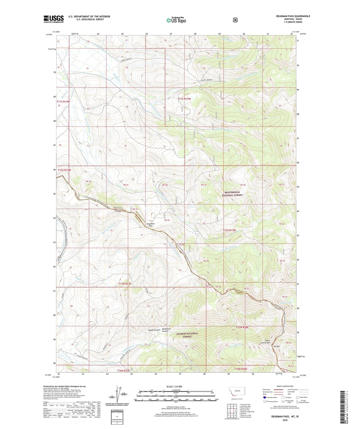
Deadman Pass Montana US Topo Map
Couldn't load pickup availability
Also explore the Deadman Pass Forest Service Topo of this same quad for updated USFS data
2024 topographic map quadrangle Deadman Pass in the states of Montana, Idaho. Scale: 1:24000. Based on the newly updated USGS 7.5' US Topo map series, this map is in the following counties: Beaverhead, Lemhi. The map contains contour data, water features, and other items you are used to seeing on USGS maps, but also has updated roads and other features. This is the next generation of topographic maps. Printed on high-quality waterproof paper with UV fade-resistant inks.
Quads adjacent to this one:
West: Bannock Pass
Northwest: Everson Creek
North: Jeff Davis Peak
Northeast: Hansen Ranch
East: Medicine Lodge Peak
Southeast: Tepee Mountain
South: Reservoir Creek
Southwest: Leadore
This map covers the same area as the classic USGS quad with code o44113g2.
Contains the following named places: Cayton Ranch, Chippie Creek, Dad Creek Lake, Deadhorse Canyon, Deadman Pass, Divide Creek, Elk Mountain, Frank Hall Creek, Horse Prairie Mountain, L-Diamond Ranch, Maiden Creek Mine, Middle Fork Maiden Creek, Rough Canyon, South Fork Maiden Creek, Whiskey Spring Creek, Wildcat Creek, Wyno