MyTopo
Saint Anthony Idaho US Topo Map
Couldn't load pickup availability
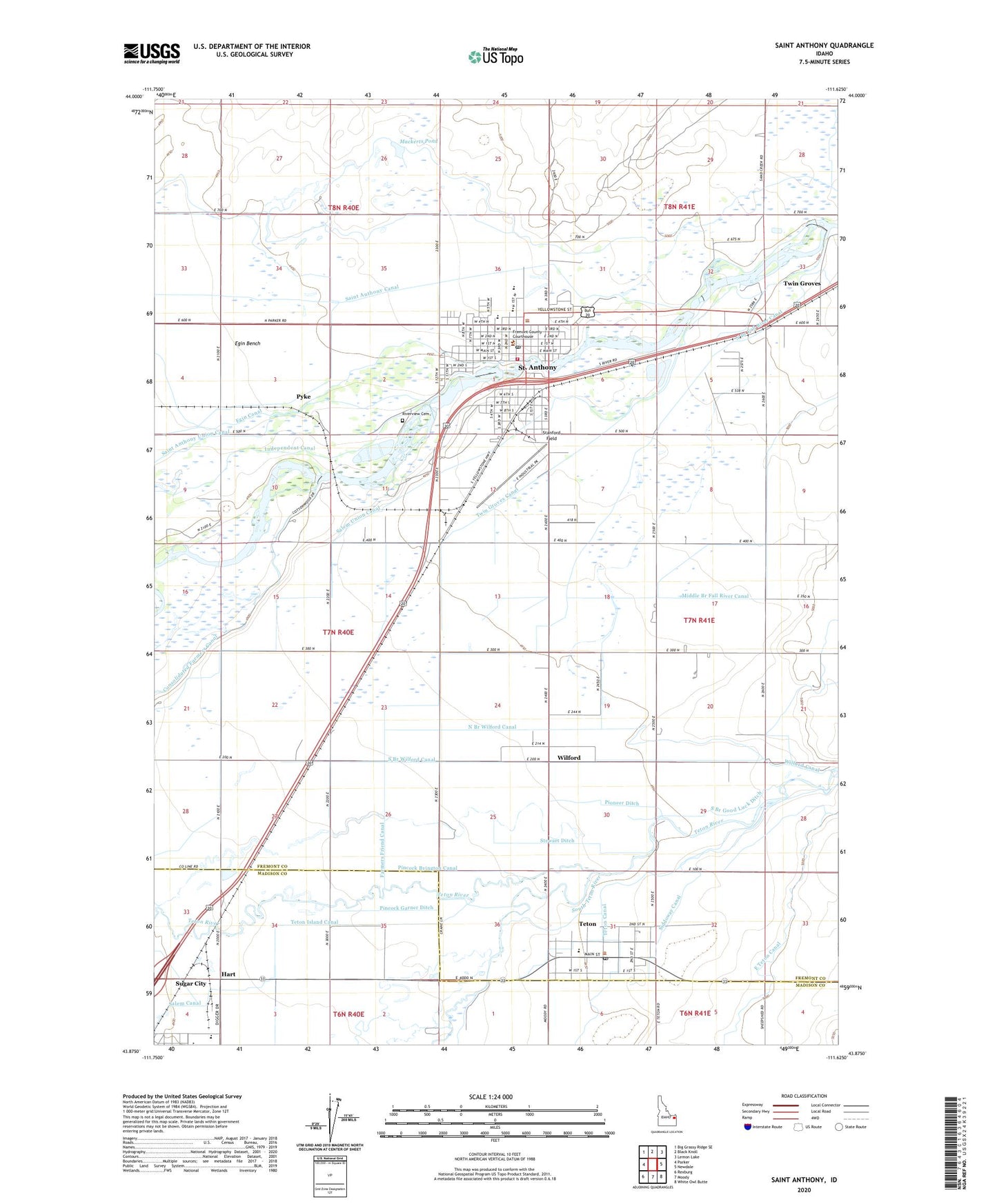
2024 topographic map quadrangle Saint Anthony in the state of Idaho. Scale: 1:24000. Based on the newly updated USGS 7.5' US Topo map series, this map is in the following counties: Fremont, Madison. The map contains contour data, water features, and other items you are used to seeing on USGS maps, but also has updated roads and other features. This is the next generation of topographic maps. Printed on high-quality waterproof paper with UV fade-resistant inks.
Quads adjacent to this one:
West: Parker
Northwest: Big Grassy Ridge SE
North: Black Knoll
Northeast: Lemon Lake
East: Newdale
Southeast: White Owl Butte
South: Moody
Southwest: Rexburg
This map covers the same area as the classic USGS quad with code o43111h6.
Contains the following named places: Central Elementary School, City of Saint Anthony, City of Teton, East Teton Canal, Farmers Friend Canal, Fremont County EMS Saint Anthony Unit, Fremont County Sherrif Department, Good Luck Ditch, Hart, Idaho Industrial Training School, Kershaw Intermediate School, KIGO-AM (Saint Anthony), Lincoln Elementary School, Mackerts Pond, Middle Branch Fall River Canal, North Branch Wilford Canal, Pincock Byington Canal, Pincock Garner Ditch, Pioneer Ditch, Pyke, Riverview Cemetery, Saint Anthony, Saint Anthony Division, Saint Anthony Police Department, Saint Anthony Post Office, Salem Union Canal, Satellite Center Preschool, Siddoway Canal, South Branch Good Luck Ditch, South Branch Wilford Canal, South Fremont High School, South Fremont Junior High School, South Fremont Rural Fire Station, Stanford Field, Stewart Ditch, Teton, Teton Canal, Teton Post Office, Teton School, Twin Groves, Twin Groves Canal, Wilford, Wilford Canal