MyTopo
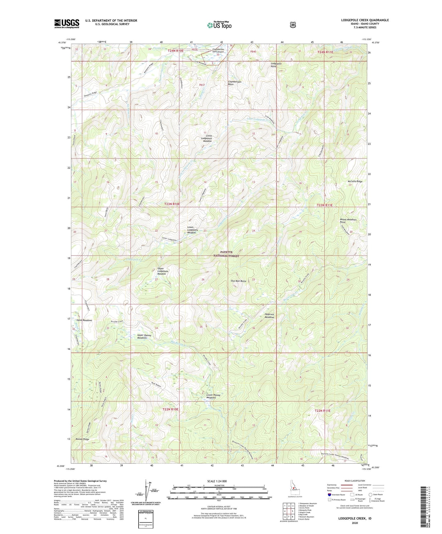
Lodgepole Creek Idaho US Topo Map
Couldn't load pickup availability
Also explore the Lodgepole Creek Forest Service Topo of this same quad for updated USFS data
2024 topographic map quadrangle Lodgepole Creek in the state of Idaho. Scale: 1:24000. Based on the newly updated USGS 7.5' US Topo map series, this map is in the following counties: Idaho. The map contains contour data, water features, and other items you are used to seeing on USGS maps, but also has updated roads and other features. This is the next generation of topographic maps. Printed on high-quality waterproof paper with UV fade-resistant inks.
Quads adjacent to this one:
West: Mosquito Peak
Northwest: Sheepeater Mountain
North: Meadow of Doubt
Northeast: Arctic Point
East: Wapiti Creek
Southeast: Acorn Butte
South: Bismark Mountain
Southwest: Big Creek
This map covers the same area as the classic USGS quad with code o45115c2.
Contains the following named places: Chamberlain Basin, Chamberlain Guard Station, Chamberlain USFS Airport, Flossie Creek, Haypress Meadows, Hotzel Creek, Hotzel Ranch, Little Lodgepole Creek, Little Lodgepole Meadow, Lodgepole Creek, Lodgepole Point, Lower Lodgepole Meadow, Lower Ramey Meadows, McCalla Ridge, Moose Creek, Moose Meadows Point, No Name Creek, One Man Butte, Pole Creek, Ranch Creek, Upper Lodgepole Meadow, Upper Ramey Meadows