MyTopo
Shoshone Idaho US Topo Map
Couldn't load pickup availability
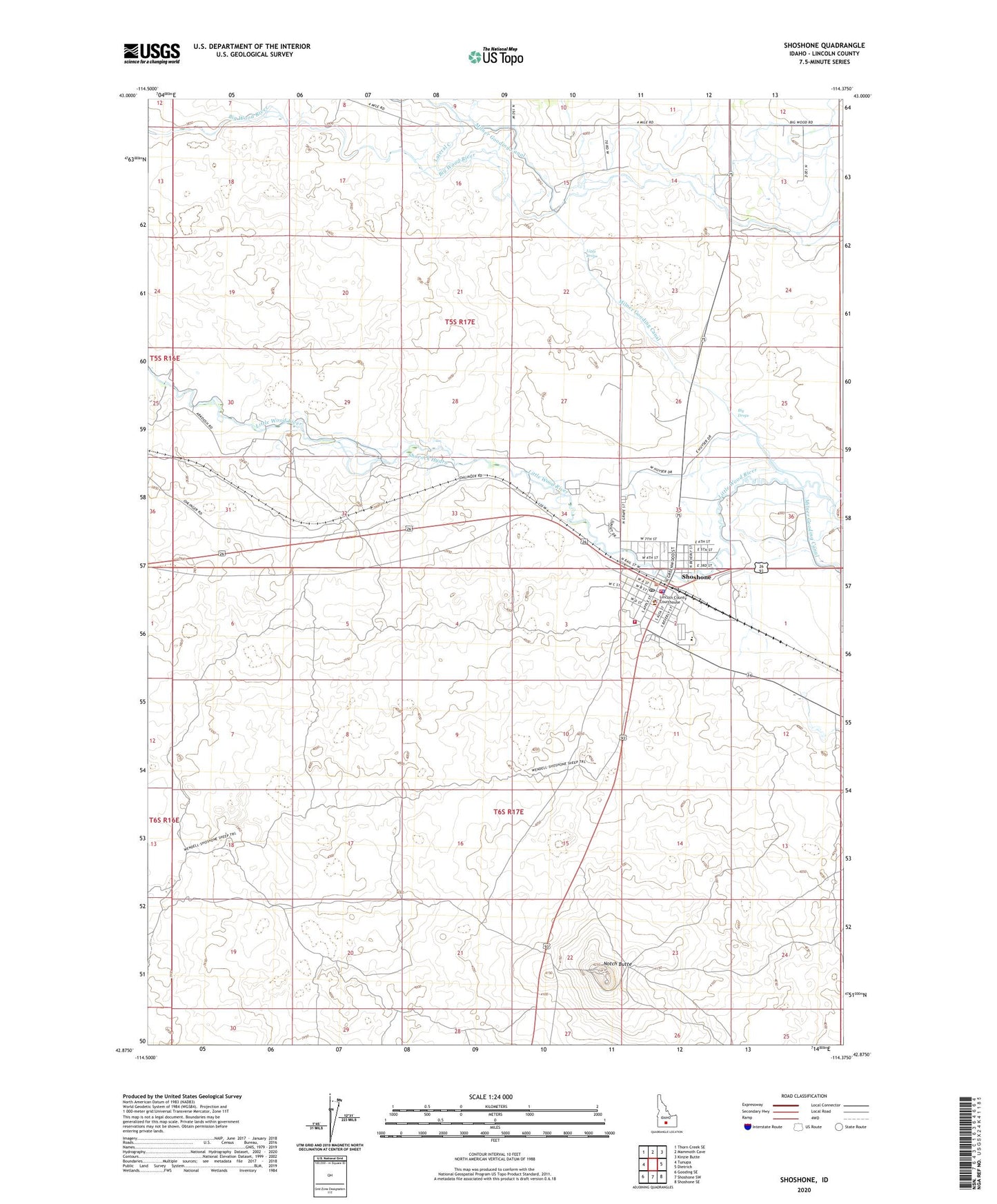
2023 topographic map quadrangle Shoshone in the state of Idaho. Scale: 1:24000. Based on the newly updated USGS 7.5' US Topo map series, this map is in the following counties: Lincoln. The map contains contour data, water features, and other items you are used to seeing on USGS maps, but also has updated roads and other features. This is the next generation of topographic maps. Printed on high-quality waterproof paper with UV fade-resistant inks.
Quads adjacent to this one:
West: Tunupa
Northwest: Thorn Creek SE
North: Mammoth Cave
Northeast: Kinzie Butte
East: Dietrich
Southeast: Shoshone SE
South: Shoshone SW
Southwest: Gooding SE
This map covers the same area as the classic USGS quad with code o42114h4.
Contains the following named places: Arkoosh Wendell Well, Big Drops, Bureau of Land Management Shoshone Field Office, City of Shoshone, Disney, Idaho Department of Transportation, Lateral C, Lincoln County Courthouse, Lincoln County Fairgrounds, Lincoln County Sheriff's Office, Lincoln Elementary School, Lincoln School, Little Drops, Little Drops Recreation Area, Mary L Gooding Memorial Park, Notch Butte, Notch Butte Hydro, Shorock Hydro, Shoshone, Shoshone BLM Heliport, Shoshone City Rural Fire District Station 1, Shoshone High School, Shoshone Landing Area, Shoshone Middle School, Shoshone Police Department, Shoshone Post Office