MyTopo
Tunupa Idaho US Topo Map
Couldn't load pickup availability
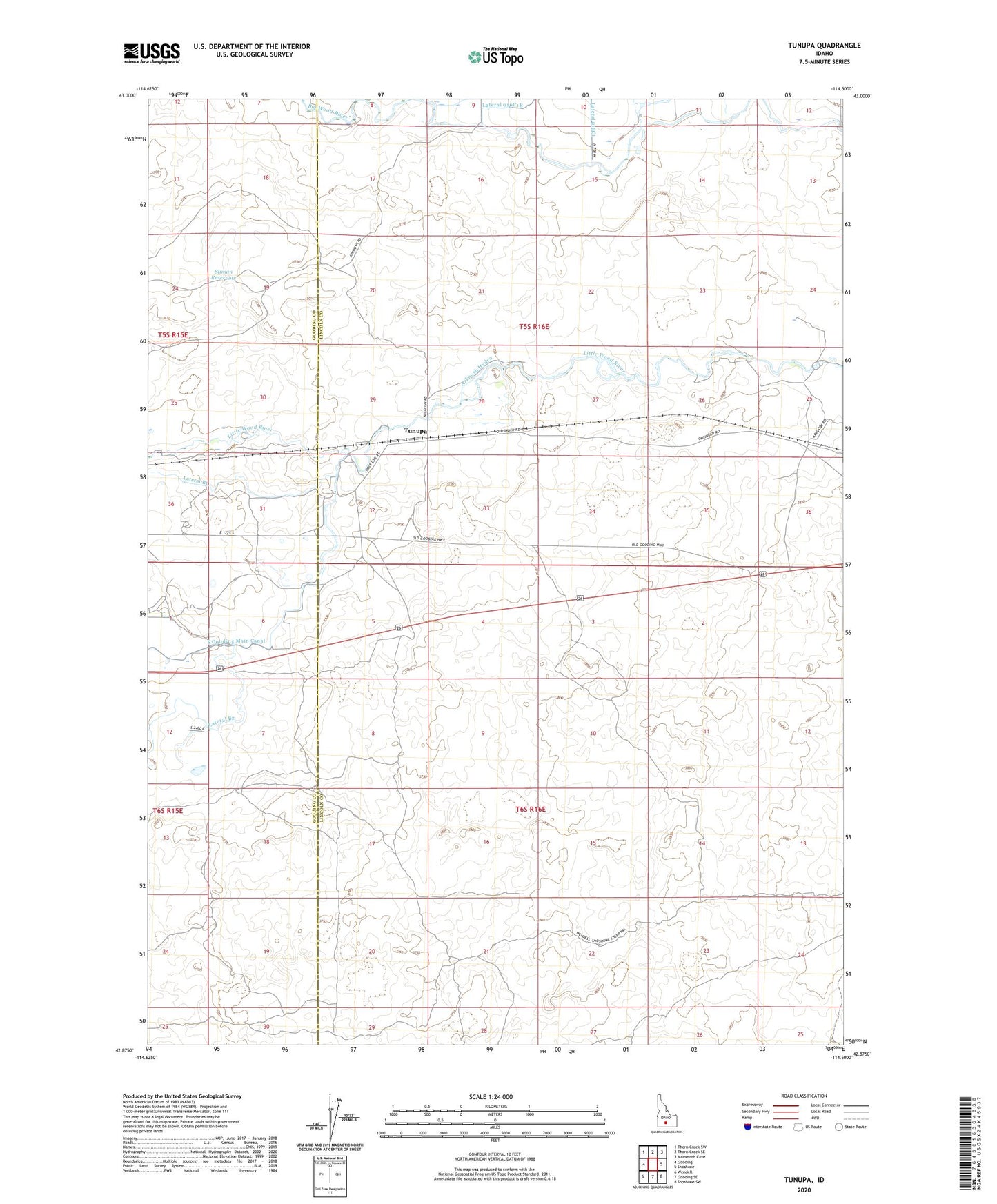
2024 topographic map quadrangle Tunupa in the state of Idaho. Scale: 1:24000. Based on the newly updated USGS 7.5' US Topo map series, this map is in the following counties: Lincoln, Gooding. The map contains contour data, water features, and other items you are used to seeing on USGS maps, but also has updated roads and other features. This is the next generation of topographic maps. Printed on high-quality waterproof paper with UV fade-resistant inks.
Quads adjacent to this one:
West: Gooding
Northwest: Thorn Creek SW
North: Thorn Creek SE
Northeast: Mammoth Cave
East: Shoshone
Southeast: Shoshone SW
South: Gooding SE
Southwest: Wendell
This map covers the same area as the classic USGS quad with code o42114h5.
Contains the following named places: Arkoosh Hydro, Jones Wendell Well, Sliman Reservoir, Tunupa