MyTopo
Mammoth Cave Idaho US Topo Map
Couldn't load pickup availability
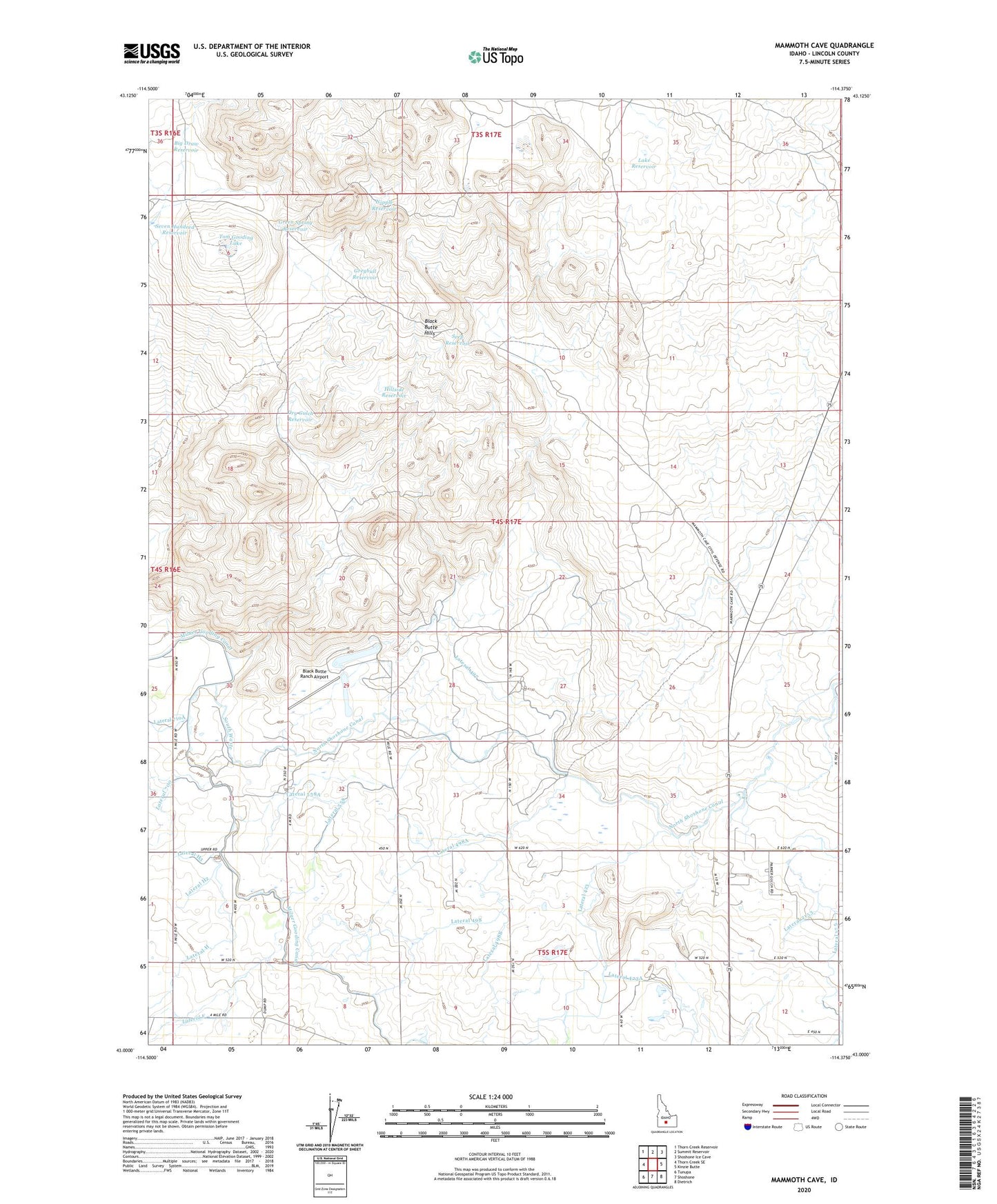
2023 topographic map quadrangle Mammoth Cave in the state of Idaho. Scale: 1:24000. Based on the newly updated USGS 7.5' US Topo map series, this map is in the following counties: Lincoln. The map contains contour data, water features, and other items you are used to seeing on USGS maps, but also has updated roads and other features. This is the next generation of topographic maps. Printed on high-quality waterproof paper with UV fade-resistant inks.
Quads adjacent to this one:
West: Thorn Creek SE
Northwest: Thorn Creek Reservoir
North: Summit Reservoir
Northeast: Shoshone Ice Cave
East: Kinzie Butte
Southeast: Dietrich
South: Shoshone
Southwest: Tunupa
This map covers the same area as the classic USGS quad with code o43114a4.
Contains the following named places: Big Draw Reservoir, Black Butte Hills, Black Butte Ranch Airport, Dry Gulch Reservoir, Green Spring Reservoir, Greybull Reservoir, Hillside Reservoir, Lake Reservoir, Lateral 175, Lateral 2153, Lateral 2157, Lateral 423, Lateral 423A, Lateral 497, Lateral 498, Lateral 498A, Lateral 498B, Lateral 558, Lateral 558A, Lateral 710, Lateral 710A, Lateral F, Lateral F1, Lateral H2, Lateral H3, Nipple Reservoir, North Gooding Canal, Seep Reservoir, Seven Hundred Reservoir, South Waste, Tom Gooding Lake, ZIP Code: 83352