MyTopo
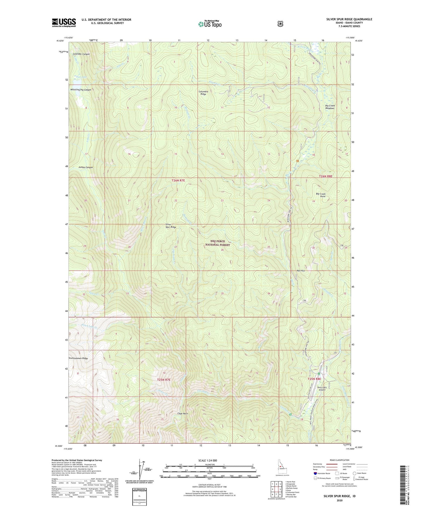
Silver Spur Ridge Idaho US Topo Map
Couldn't load pickup availability
Also explore the Silver Spur Ridge Forest Service Topo of this same quad for updated USFS data
2024 topographic map quadrangle Silver Spur Ridge in the state of Idaho. Scale: 1:24000. Based on the newly updated USGS 7.5' US Topo map series, this map is in the following counties: Idaho. The map contains contour data, water features, and other items you are used to seeing on USGS maps, but also has updated roads and other features. This is the next generation of topographic maps. Printed on high-quality waterproof paper with UV fade-resistant inks.
Quads adjacent to this one:
West: Buffalo Hump
Northwest: North Pole
North: Orogrande
Northeast: Moose Butte
East: Dixie
Southeast: Fivemile Bar
South: Mackay Bar
Southwest: Cottontail Point
This map covers the same area as the classic USGS quad with code o45115e5.
Contains the following named places: Big Creek, Big Creek Meadows, Big Creek Point, Calendar Canyon, Cape Horn, Dixie Royal Mine, Dixie USFS Airport, Dixie Work Center, Eutopia Creek, Eutopia Mine, Fawn Creek, Fawn Lake Creek, Fish Lake, Gold Master Mine, Goldbug Mine, Halfway House Campground, Hay Fork, Hematite Mine, Herman Creek, Jim Sandy Creek, Johnson Cabin, Jumbo Canyon, Lake Creek, Lemon Creek, Little Blowout Creek, McGuire Creek, Moose Meadow Creek, Nut Hill, Pete Creek, Power Creek, Silver Spur Creek, Silver Spur Ridge, Straight Creek, Union Group Mines, West Fork Big Creek, Whistling Pig Canyon, Whistling Pig Creek